Category:Data license Germany-attribution-2.0
Jump to navigation
Jump to search
| Upload media | |||||
| Instance of |
| ||||
|---|---|---|---|---|---|
| Full work available at URL | |||||
| |||||
Pages in category "Data license Germany-attribution-2.0"
This category contains only the following page.
Media in category "Data license Germany-attribution-2.0"
The following 200 files are in this category, out of 66,306 total.
(previous page) (next page)-
 01 dtk10 32384 5666 2 nw col.tif 4,000 × 4,000; 1.05 MB
-
_-_cropped.jpg/120px-1954_2954_pan_(Schrägluftbilder_West-Berlins%2C_Stettiner_Bahnhof)_-_cropped.jpg) 1954 2954 pan (Schrägluftbilder West-Berlins, Stettiner Bahnhof) - cropped.jpg 7,645 × 4,939; 6.5 MB
1954 2954 pan (Schrägluftbilder West-Berlins, Stettiner Bahnhof) - cropped.jpg 7,645 × 4,939; 6.5 MB
-
.jpg/116px-1954_2954_pan_(Schrägluftbilder_West-Berlins%2C_Stettiner_Bahnhof).jpg) 1954 2954 pan (Schrägluftbilder West-Berlins, Stettiner Bahnhof).jpg 8,256 × 8,551; 5.69 MB
1954 2954 pan (Schrägluftbilder West-Berlins, Stettiner Bahnhof).jpg 8,256 × 8,551; 5.69 MB
-
_-_cropped.jpg/120px-1954_2957_pan_(Schrägluftbilder_West-Berlins%2C_Kreuzung_Liesenstraße_Gartenstraße%2C_St._Sebastian-Kirche%2C_Stettiner_Bahnhof)_-_cropped.jpg)
-
.jpg/116px-1954_2957_pan_(Schrägluftbilder_West-Berlins%2C_Kreuzung_Liesenstraße_Gartenstraße%2C_St._Sebastian-Kirche%2C_Stettiner_Bahnhof).jpg)
-
 1988-1994 Aerial view Clouth area.png 1,515 × 1,748; 1.56 MB
-
 2020 Bilstein Schrägluftbild.png 1,503 × 855; 2.58 MB
-
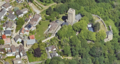
 2020 Blick auf Schloss Hohenlimburg.png 1,314 × 856; 2.38 MB
-
 2020 Luftbild AKH.png 1,541 × 856; 2.56 MB
-
 2020 Luftbild Altenhagen.png 1,274 × 854; 2.45 MB
-
 2020 Luftbild Ambrock.png 1,259 × 854; 2.2 MB
-
 2020 Luftbild Autobahnkreuz Hagen.png 951 × 845; 1.66 MB
-
 2020 Luftbild Bahnhofsplatz.png 1,643 × 857; 2.83 MB
-
 2020 Luftbild Bahnhofsviertel.png 1,492 × 841; 2.69 MB
-
 2020 Luftbild Bathey.png 945 × 854; 1.65 MB
-
 2020 Luftbild Baukloh.png 1,275 × 853; 2.35 MB
-
 2020 Luftbild Bechem.png 1,431 × 858; 2.2 MB
-
 2020 Luftbild Berchum.png 1,273 × 847; 2.06 MB
-
 2020 Luftbild Bilstein Werk Berchum.png 1,414 × 857; 2.15 MB
-
 2020 Luftbild Bilstein Werk II.png 1,200 × 857; 1.91 MB
-
 2020 Luftbild Boele.png 1,268 × 855; 2.44 MB
-
 2020 Luftbild Boelerheide.png 1,276 × 857; 2.45 MB
-
 2020 Luftbild Brechtefeld.png 1,335 × 858; 2.09 MB
-
 2020 Luftbild Buschey-Friedhof.png 1,494 × 857; 2.52 MB
-
 2020 Luftbild Buschmühle.png 1,546 × 858; 2.23 MB
-
 2020 Luftbild Bölling.png 1,506 × 857; 2.47 MB
-
 2020 Luftbild Dahl.png 1,276 × 854; 2.43 MB
-
 2020 Luftbild Dahler Kirche.png 1,528 × 857; 2.4 MB
-
 2020 Luftbild Deipenbrink.png 1,547 × 857; 2.51 MB
-
 2020 Luftbild Delstern.png 1,272 × 842; 2.25 MB
-
 2020 Luftbild Dörken.png 1,526 × 850; 2.64 MB
-
 2020 Luftbild Eckesey.png 1,277 × 855; 2.35 MB
-
 2020 Luftbild Ehemalige Hofstelle Rönsel.png 1,400 × 857; 2.3 MB
-
 2020 Luftbild Eilpe.png 1,279 × 854; 2.42 MB
-
 2020 Luftbild Eisenbahn-Ruhrbrücke.png 1,550 × 856; 2.32 MB
-
 2020 Luftbild Elsey, Kirchenbergstadion.png 951 × 857; 1.77 MB
-
 2020 Luftbild Elsey.png 1,641 × 857; 2.9 MB
-
 2020 Luftbild Elseyer Kirche.png 1,234 × 754; 1.76 MB
-
 2020 Luftbild Enervie-Verwaltung.png 1,518 × 858; 2.47 MB
-
 2020 Luftbild Eugen-Richter-Turm.png 1,358 × 842; 2.01 MB
-
 2020 Luftbild Fachhochschule Hagen.png 1,545 × 855; 2.59 MB
-
 2020 Luftbild Fahrentrappe.png 1,356 × 855; 2 MB
-
 2020 Luftbild FernUniversität.png 1,394 × 850; 2.37 MB
-
 2020 Luftbild Flehinghaus.png 1,539 × 857; 2.52 MB
-
 2020 Luftbild Fley.png 1,273 × 850; 2.26 MB
-
 2020 Luftbild Freiherr-vom-Stein-Turm.png 1,327 × 853; 1.98 MB
-
 2020 Luftbild Freilichtmuseum.png 1,476 × 856; 2.53 MB
-
 2020 Luftbild Garenfeld Nord.png 1,275 × 858; 2.25 MB
-
 2020 Luftbild Garenfeld.png 953 × 856; 1.54 MB
-
 2020 Luftbild Gesamtschule Haspe.png 1,335 × 858; 2.21 MB
-
 2020 Luftbild Griesenbecke.png 1,460 × 855; 2.17 MB
-
 2020 Luftbild Gut Schede.png 1,506 × 856; 2.3 MB
-
 2020 Luftbild Güterbahnhof Eckesey.png 1,266 × 819; 2.17 MB
-
 2020 Luftbild Güterbahnhof Oege.png 1,565 × 856; 2.68 MB
-
 2020 Luftbild Hagener Museumsquartier.png 1,250 × 788; 1.98 MB
-
 2020 Luftbild Halden.png 1,267 × 858; 2.41 MB
-
 2020 Luftbild Haspe Innenstadt.png 1,568 × 857; 2.83 MB
-
 2020 Luftbild Haspe.png 1,258 × 819; 2.19 MB
-
 2020 Luftbild Hasper Talsperre.png 955 × 782; 1.32 MB
-
 2020 Luftbild Haßley.png 1,442 × 858; 2.39 MB
-
 2020 Luftbild Haus Busch.png 1,441 × 858; 2.17 MB
-
 2020 Luftbild Haus Ende.png 1,446 × 858; 2.29 MB
-
 2020 Luftbild Haus Harkorten.png 1,629 × 852; 2.46 MB
-
 2020 Luftbild Haus Mallinckrodt.png 1,467 × 857; 2.3 MB
-
 2020 Luftbild Heizkraftwerk Kabel.png 1,409 × 855; 2.35 MB
-
 2020 Luftbild Helfe.png 1,275 × 856; 2.46 MB
-
 2020 Luftbild Hengstey.png 1,268 × 822; 1.79 MB
-
 2020 Luftbild Hengsteysee 1.png 1,430 × 837; 2.02 MB
-
 2020 Luftbild Hengsteysee 2.png 1,270 × 837; 2.08 MB
-
 2020 Luftbild Hengsteysee, Bathey.png 1,271 × 835; 2.03 MB
-
 2020 Luftbild Herbeck.png 1,271 × 857; 2.13 MB
-
 2020 Luftbild Herdecke Bleichstein.png 1,517 × 855; 2.37 MB
-
.png/120px-2020_Luftbild_Herdecke_Innenstadt_(2).png) 2020 Luftbild Herdecke Innenstadt (2).png 1,559 × 856; 2.84 MB
2020 Luftbild Herdecke Innenstadt (2).png 1,559 × 856; 2.84 MB
-
 2020 Luftbild Herdecke Innenstadt.png 1,581 × 857; 2.87 MB
-
 2020 Luftbild Hildegardis-Schule.png 1,611 × 858; 2.41 MB
-
 2020 Luftbild Hobräck.png 1,448 × 857; 2.05 MB
-
 2020 Luftbild Hohenlimburg Innenstadt.png 1,271 × 849; 2.34 MB
-
 2020 Luftbild Hohenlimburger Kalkwerke.png 1,519 × 858; 2.46 MB
-
 2020 Luftbild Holthausen.png 1,276 × 851; 2.17 MB
-
 2020 Luftbild Hugo Vogelsang - Bilstein Group.png 1,550 × 854; 2.34 MB
-
 2020 Luftbild Hunsdiek.png 1,552 × 852; 2.42 MB
-
 2020 Luftbild Hückinghausen.png 1,587 × 857; 2.5 MB
-
 2020 Luftbild Hünenpforte.png 1,569 × 857; 2.64 MB
-
 2020 Luftbild Ischeland.png 1,263 × 832; 2.31 MB
-
 2020 Luftbild Ischelandstadion.png 1,533 × 858; 2.43 MB
-
 2020 Luftbild Johanniskirche Hagen.png 1,588 × 858; 2.32 MB
-
 2020 Luftbild Kabel.png 1,266 × 857; 2.37 MB
-
 2020 Luftbild Kaiser-Friedrich-Turm.png 1,394 × 840; 2.15 MB
-
 2020 Luftbild Kaiser-Wilhelm-Denkmal.png 1,469 × 854; 2.1 MB
-
 2020 Luftbild Kirchenberg.png 1,413 × 855; 2.5 MB
-
 2020 Luftbild Klinik Ambrock.png 1,573 × 854; 2.53 MB
-
 2020 Luftbild Klärwerk Hagen.png 1,357 × 852; 2.02 MB
-
 2020 Luftbild Kraftwerk Cuno.png 954 × 854; 1.4 MB
-
 2020 Luftbild Krankenhaus Herdecke.png 1,310 × 858; 2.16 MB
-
 2020 Luftbild Kuhlerkamp.png 1,264 × 851; 2.37 MB
-
 2020 Luftbild Landgericht.png 1,414 × 853; 2.55 MB
-
 2020 Luftbild Laufwasserkraftwerk Hengstey.png 1,434 × 855; 2.19 MB
-
 2020 Luftbild Laufwasserkraftwerk Stiftsmühle.png 1,476 × 855; 2.25 MB
-
 2020 Luftbild LB Eichen bei Haßley.png 1,353 × 856; 2.14 MB
-
 2020 Luftbild LB Hangwiese und Gehölzstreifen Werninghausen.png 1,175 × 785; 1.81 MB
-
 2020 Luftbild LB Helbecke.png 1,329 × 821; 1.89 MB
-
 2020 Luftbild LB Kleingewässer Hückinghausen.png 1,494 × 857; 2.22 MB
-
 2020 Luftbild LB Teichanlage Brechtefeld-Kalthausen.png 1,381 × 858; 2.11 MB
-
 2020 Luftbild Lehrkind.png 1,504 × 857; 2.31 MB
-
 2020 Luftbild Lindenhof.png 1,460 × 857; 2.33 MB
-
 2020 Luftbild Linscheid.png 1,482 × 858; 2.36 MB
-
 2020 Luftbild Marienhof.png 1,554 × 857; 2.32 MB
-
 2020 Luftbild Nahmertal.png 1,255 × 852; 2.23 MB
-
 2020 Luftbild Naturschutzgebiet Felderbachtal.png 1,506 × 857; 2.43 MB
-
 2020 Luftbild Niggenbölling.png 1,511 × 858; 2.26 MB
-
 2020 Luftbild NSG Ehemaliger Yachthafen Harkortsee.png 1,610 × 858; 2.1 MB
-
 2020 Luftbild Obergraben-Ruhr-Brücken.png 1,451 × 843; 1.91 MB
-
 2020 Luftbild Oege, Nahmer, Innenstadt.png 1,267 × 835; 2.24 MB
-
 2020 Luftbild Priorei.png 1,268 × 852; 2.2 MB
-
 2020 Luftbild Quambusch.png 1,278 × 857; 2.41 MB
-
 2020 Luftbild Reformierte Kirche.png 1,444 × 855; 2.21 MB
-
 2020 Luftbild Reh, Henkhausen.png 1,276 × 824; 2.24 MB
-
 2020 Luftbild Remberg-Friedhof.png 1,374 × 858; 2.47 MB
-
 2020 Luftbild Ruhr-Viadukt.png 947 × 719; 1.35 MB
-
 2020 Luftbild Rummenohl.png 1,262 × 854; 2.18 MB
-
 2020 Luftbild Rumscheid.png 1,454 × 855; 2.33 MB
-
 2020 Luftbild Rüggebein.png 1,527 × 857; 2.32 MB
-
 2020 Luftbild Selkinghausen.png 1,566 × 858; 2.46 MB
-
 2020 Luftbild Sparkasse Hagen.png 1,323 × 858; 2.17 MB
-
 2020 Luftbild Sportplatz Kirchende.png 1,470 × 851; 2.27 MB
-
 2020 Luftbild Sportplatz Vorhalle.png 1,565 × 857; 2.64 MB
-
 2020 Luftbild St. Bonifatius Kirche.png 1,542 × 855; 2.29 MB
-
 2020 Luftbild St. Elisabeth Hagen.png 1,525 × 855; 2.35 MB
-
 2020 Luftbild St. Marien Hagen.png 1,615 × 858; 2.49 MB
-
 2020 Luftbild Steinbruch Donnerkuhle.png 954 × 846; 1.53 MB
-
 2020 Luftbild Steinbruch Rolloch.png 950 × 851; 1.75 MB
-
 2020 Luftbild Stiftsviertel Herdecke.png 1,436 × 855; 2.42 MB
-
 2020 Luftbild Thyssenkrupp, Oege.png 1,262 × 834; 2.19 MB
-
 2020 Luftbild Thyssenkrupp.png 1,483 × 857; 2.54 MB
-
 2020 Luftbild Tiefendorf.png 943 × 849; 1.45 MB
-
 2020 Luftbild Volmeabstieg.png 945 × 854; 1.72 MB
-
 2020 Luftbild Vorhalle.png 1,264 × 858; 2.42 MB
-
.png/120px-2020_Luftbild_Waelzholz_(Theis).png) 2020 Luftbild Waelzholz (Theis).png 1,334 × 856; 2.22 MB
2020 Luftbild Waelzholz (Theis).png 1,334 × 856; 2.22 MB
-
 2020 Luftbild Wallburg Ambrock.png 1,570 × 858; 2.71 MB
-
 2020 Luftbild Waterhövel.png 1,574 × 855; 2.6 MB
-
 2020 Luftbild Weißenstein.png 1,199 × 752; 1.75 MB
-
 2020 Luftbild Werninghausen.png 1,565 × 856; 2.5 MB
-
 2020 Luftbild Wesselbachtal.png 949 × 770; 1.52 MB
-
 2020 Luftbild Westerbauer.png 1,265 × 858; 2.33 MB
-
 2020 Luftbild Westfalenbad.png 1,538 × 855; 2.56 MB
-
 2020 Luftbild Wildwasserpark.png 1,463 × 858; 2.37 MB
-
 2020 Luftbild Wippermann.png 1,237 × 858; 2.04 MB
-
 2020 Luftbild Zur Höhe.png 1,533 × 856; 2.74 MB
-
 2020 Luftblid Kalthausen.png 1,472 × 857; 2.32 MB
-
 2020 Neubau Lennetalbrücke.png 1,775 × 855; 3.07 MB
-
 2020 Papierfabrik Kabel.png 1,477 × 851; 2.4 MB
-
 2020 Rangierbahnhof Vorhalle.png 953 × 750; 1.62 MB
-
 2020 Rathaus Hohenlimburg.png 1,570 × 858; 2.31 MB
-
 2020 Schloss Hohenlimburg.png 1,435 × 816; 2.05 MB
-
 2020 Schrägluftbild DEW Hagen.png 1,532 × 855; 2.59 MB
-
 2020 Schrägluftbild Hagen Hbf 1.png 1,599 × 855; 2.73 MB
-
 2020 Schrägluftbild Hagen Hbf 2.png 945 × 702; 1.47 MB
-
 2020 Schrägluftbild Hof Bärwinkel.png 1,409 × 852; 2.1 MB
-
 2020 Schrägluftbild Rathaus Hagen.png 1,498 × 856; 2.41 MB
-
 2020 Steinbruch Donnerkuhle.png 1,276 × 850; 2.01 MB
-
 2020 Umspannwerk Garenfeld.png 951 × 700; 1.25 MB
-
 2020 Wasserschloss Werdringen.png 1,217 × 783; 1.75 MB
-
 2021 Haus Kemnade.png 1,267 × 765; 2.1 MB
-
 2021 Henrichshütte Hattingen.png 1,355 × 765; 2.32 MB
-
 2021 Kraftwerk Harkort.png 1,471 × 760; 2.27 MB
-
 2021 Luftbild Altenbreckerfeld.png 1,262 × 761; 1.82 MB
-
 2021 Luftbild Bismarckturm Hagen.png 1,367 × 759; 2.34 MB
-
 2021 Luftbild Blankenstein, Welper.png 1,275 × 762; 2.87 MB
-
 2021 Luftbild Breckerfeld-Mitte.png 1,328 × 760; 2.33 MB
-
 2021 Luftbild Breckerfeld.png 1,273 × 763; 2.37 MB
-
 2021 Luftbild Bredenscheid-Stüter.png 1,275 × 762; 2.15 MB
-
 2021 Luftbild Brenscheid.png 1,275 × 757; 1.8 MB
-
 2021 Luftbild Briefzentrum Hagen.png 1,386 × 766; 2.16 MB
-
 2021 Luftbild Brockhausen.png 1,587 × 858; 3.03 MB
-
 2021 Luftbild Burg Blankenstein.png 1,407 × 756; 2.46 MB
-
 2021 Luftbild Burg Volmarstein.png 1,439 × 761; 2.47 MB
-
 2021 Luftbild Dahler Kirche, Haus Dahl.png 1,222 × 761; 1.84 MB
-
 2021 Luftbild Delstern-Süd.png 1,266 × 767; 2.23 MB
-
 2021 Luftbild DHL Freight GmbH Hagen.png 1,458 × 761; 2.41 MB
-
 2021 Luftbild Elbershallen.png 1,292 × 771; 2.21 MB
-
 2021 Luftbild Erbbegräbnis Haus Busch.png 1,210 × 763; 1.82 MB
-
 2021 Luftbild Forellenzucht Huxel.png 1,378 × 762; 2.12 MB
-
 2021 Luftbild Freibad Hestert.png 1,598 × 857; 2.95 MB
-
.png/120px-2021_Luftbild_Freiheit_Wetter_(1).png) 2021 Luftbild Freiheit Wetter (1).png 1,398 × 754; 2.28 MB
2021 Luftbild Freiheit Wetter (1).png 1,398 × 754; 2.28 MB
-
.png/120px-2021_Luftbild_Freiheit_Wetter_(2).png) 2021 Luftbild Freiheit Wetter (2).png 1,335 × 764; 2.17 MB
2021 Luftbild Freiheit Wetter (2).png 1,335 × 764; 2.17 MB
-
 2021 Luftbild Gewerbegebiet Reh.png 1,273 × 783; 2.31 MB
-
 2021 Luftbild Glörtalsperre.png 1,261 × 753; 2.09 MB
-
 2021 Luftbild Golfplatz Tiefendorf.png 1,562 × 856; 2.42 MB
-
 2021 Luftbild Gut Herbeck.png 1,588 × 857; 2.97 MB
-
 2021 Luftbild Harkortturm.png 1,372 × 766; 1.9 MB
-
 2021 Luftbild Hattingen, Ruhr, Baak.png 1,273 × 765; 2.23 MB
-
 2021 Luftbild Hattingen, St. Georg.png 1,406 × 761; 2.44 MB
-
 2021 Luftbild Hattingen-Mitte.png 1,275 × 763; 2.43 MB
-
 2021 Luftbild Hohenhof.png 1,211 × 760; 2.06 MB
-
 2021 Luftbild Kläranlage Hagen-Fley.png 1,583 × 855; 2.35 MB
-
 2021 Luftbild Motodrom Hagen.png 1,303 × 761; 2.28 MB
-
 2021 Luftbild Niederelfringhausen.png 1,273 × 754; 2.05 MB
-
.png/120px-2021_Luftbild_Niederschultenhof_(Maihof).png) 2021 Luftbild Niederschultenhof (Maihof).png 1,290 × 763; 2.07 MB
2021 Luftbild Niederschultenhof (Maihof).png 1,290 × 763; 2.07 MB
-
 2021 Luftbild Oberelfringhausen.png 1,274 × 761; 1.99 MB
-
 2021 Luftbild Oberhagen.png 1,550 × 857; 3.13 MB
_-_cropped.jpg)
.jpg)
_-_cropped.jpg)
.jpg)


.png)


.png)


.png)
.png)


.png)

