Category:Earth science diagrams
Jump to navigation
Jump to search

Wikimedia category | |||||
| Upload media | |||||
| Instance of | |||||
|---|---|---|---|---|---|
| |||||
Diagrams in the fields of the Earth sciences
Subcategories
This category has the following 21 subcategories, out of 21 total.
!
A
- Axial tilt (or Obliquity) (20 F)
B
- Biogeographical diagrams (37 F)
C
E
G
H
M
O
P
R
- Diagrams of remote sensing (85 F)
S
- Diagrams of streams (9 F)
T
Media in category "Earth science diagrams"
The following 20 files are in this category, out of 20 total.
-
 Ages of flood basalt events 1.png 1,560 × 1,600; 192 KB
-
 Cool tropics paradox.svg 326 × 218; 52 KB
-
 Daysperyear.png 481 × 289; 22 KB
-
 Earth Energy Imbalance and Excess Heat Inventory 2018.png 2,849 × 2,491; 339 KB
-
 External electron transfer strategies.png 1,100 × 506; 41 KB
-
 Global carbon stocks.png 2,550 × 1,053; 115 KB
-
 Global Energy Budget Diagram.png 2,500 × 1,773; 2.61 MB
-
 Omics data and marine phytoplankton.jpg 1,317 × 467; 188 KB
-
 Planetare Belastungsgrenzen 2022.png 1,929 × 1,989; 425 KB
-
 Portail sciences de la terre.png 640 × 480; 38 KB
-

-
 Structural levels of nature systems and organization of life.svg 586 × 820; 683 KB
-
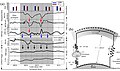
_-_figure_19.jpg/111px-The_origin_of_continents_and_oceans_-_Wegener_(1924)_-_figure_19.jpg) The origin of continents and oceans - Wegener (1924) - figure 19.jpg 1,736 × 1,882; 500 KB
The origin of continents and oceans - Wegener (1924) - figure 19.jpg 1,736 × 1,882; 500 KB
-
 Upper-lower.jpg 3,291 × 1,934; 1.17 MB
-
 Variazione orbitale.png 350 × 260; 16 KB
-

-
 Wechselwirkungen der Erd-Lebenssysteme.png 3,508 × 3,070; 322 KB
-
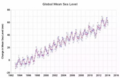 全球海平面.png 365 × 237; 84 KB
-
 因果關係圖.png 513 × 109; 6 KB
-
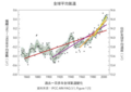 過去一百多年全球氣溫變化.png 377 × 268; 58 KB


_-_figure_19.jpg)


