Category:Maps of Africa
Jump to navigation
Jump to search
Temperate regions: North America · South America · Africa · Europe · Asia · Oceania – Polar regions: Antarctica · Arctic – Other regions: Afro-Eurasia · Eurasia
Wikimedia category | |||||
| Upload media | |||||
| Instance of | |||||
|---|---|---|---|---|---|
| Category combines topics | |||||
 | |||||
Maps of Africa.
- Maps are also available as part of the
 Wikimedia Atlas of the World project in the Atlas of Africa.
Subcategories
This category has the following 70 subcategories, out of 70 total.
!
*
- Global maps centered 20W (4 F)
- Global maps centered Greenwich (173 F)
+
A
- Afrotropical realm maps (1 P, 8 F)
- Atlas of Africa (69 P, 10 F)
B
C
- CIA maps of Africa (14 F)
D
E
- Maps of education in Africa (3 F)
F
G
H
I
- IUCN distribution maps of Africa (69 F)
L
- Law-related maps of Africa (20 F)
- LGBT-related maps of Africa (7 F)
M
- Maps of the world's nations (80 F)
- Membership maps of Africa (7 F)
- Military maps of Africa (3 F)
O
P
- Plaques shaped like Africa (1 F)
R
S
- Sea level maps of Africa (5 F)
- Slope maps of Africa (3 F)
T
- Time zone maps of Africa (9 F)
W
- Weather maps of Africa (3 F)
Media in category "Maps of Africa"
The following 200 files are in this category, out of 795 total.
(previous page) (next page)-
10705 2017 9870 Fig5 HTML.webp 728 × 992; 184 KB
-
14 pays du 2iE.jpg 1,134 × 772; 84 KB
-
2014 Ebola outbreak-countries in Africa with active transmission.png 585 × 600; 50 KB
-
2019 ACN Qualification 2.png 360 × 360; 7 KB
-
2021 Arab Cup Map 2.png 677 × 367; 13 KB
-
2021 Arab Cup Map.svg 512 × 537; 141 KB
-
2021 Arab Women's Cup.png 360 × 360; 15 KB
-
3c76166d37fafc007d28e9c80d36e9281290432841011755400.png 630 × 409; 13 KB
-
A C N 2013.png 677 × 681; 19 KB
-
Aden. Mombaza. Quiloa. Cefala, 1500-1699 – BEIC IE8998017.jpg 3,504 × 1,341; 1.56 MB
-
ADPA map.png 349 × 339; 6 KB
-
AfLIA member countries (2019).png 4,800 × 4,795; 1.14 MB
-
AFR V1 D091 Head of the Ibrahimieh canal.jpg 1,754 × 2,423; 624 KB
-
AFR V1 D093 Entrance of the Fayum.jpg 1,748 × 1,891; 670 KB
-
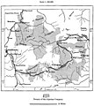
AFR V1 D171 Chief Routes of Abyssinian Explorers.jpg 1,798 × 2,865; 479 KB
-
AFR V1 D245 Routes of the Chief Explorers in the Lower Awash Region.jpg 1,760 × 1,865; 230 KB
-
AFR V1 D407 The Natron lakes.jpg 1,763 × 1,366; 405 KB
-
AFR V1 D461 Assuan and the first cataract before the opening of the railway.jpg 1,781 × 1,912; 675 KB
-
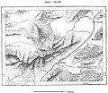
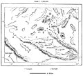
AFR V2 D042 Group of the Aujila oases.jpg 1,744 × 1,377; 147 KB
-
AFR V2 D079 Khoms coast district, Tripolitania.jpg 1,752 × 1,716; 387 KB
-
AFR V2 D093 Oases of Fezzan.jpg 1,793 × 1,389; 366 KB
-
AFR V2 D107 The Ghadames oasis.jpg 1,815 × 2,050; 602 KB
-
AFR V2 D164 Native inhabitants of Tunis.jpg 1,707 × 2,631; 743 KB
-
AFR V2 D179 Jerid, Tunisia.jpg 1,792 × 1,208; 233 KB
-
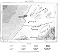
AFR V2 D215 La Goletta Tunisia.jpg 1,529 × 2,779; 551 KB
-
AFR V2 D225 Plain of Gardimau.jpg 1,823 × 1,599; 515 KB
-
AFR V2 D228 Ruins of Utica.jpg 1,774 × 1,570; 304 KB
-
AFR V2 D236 Railways and highways of Tunis.jpg 1,546 × 2,602; 466 KB
-
AFR V2 D253 Erosions of the mountains near Tiaret.jpg 1,843 × 1,593; 426 KB
-
AFR V2 D255 Junction of the geodetic lines between Algeria and Spain.jpg 1,801 × 2,244; 593 KB
-
AFR V2 D257 Ancient glaciers of the Haizer mountains.jpg 1,782 × 1,617; 410 KB
-
AFR V2 D258 Gorges of the Wed Agriun.jpg 1,656 × 2,489; 951 KB
-
AFR V2 D261 Cape de Fer.jpg 1,748 × 1,656; 389 KB
-
AFR V2 D264 Lakes of La Calle.jpg 1,777 × 1,526; 361 KB
-
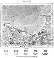
AFR V2 D268 Shott Melhigh and projected inland sea.jpg 1,801 × 1,774; 301 KB
-
AFR V2 D269 Artesian Wells of Ziban and the Wed Righ.jpg 1,691 × 2,328; 378 KB
-
AFR V2 D270 Barrage of the Hamiz.jpg 1,155 × 2,408; 571 KB
-
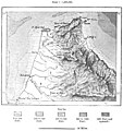
AFR V2 D272 Rainfall of the Sahara in 1884.jpg 1,747 × 1,393; 462 KB
-
AFR V2 D282 Chief ancient cities of Algeria.jpg 1,758 × 1,034; 378 KB
-
AFR V2 D284 Chief Tribes of Algeria.jpg 1,758 × 1,285; 480 KB
-
AFR V2 D294 Suk-Ahras and its environs.jpg 1,761 × 1,640; 772 KB
-
AFR V2 D302 Edugh and Lake Fetzara.jpg 1,888 × 1,182; 425 KB
-
AFR V2 D319 Zwawa and Ait-Iraten Territory.jpg 1,799 × 2,345; 771 KB
-
AFR V2 D330 Palestro and Gorges of the Isser.jpg 1,759 × 2,515; 906 KB
-
AFR V2 D331 Lower Sebau and Isser valleys.jpg 1,764 × 1,792; 530 KB
-
AFR V2 D338 Military lines of Algiers.jpg 1,722 × 2,407; 864 KB
-
AFR V2 D340 Algerian Sahel.jpg 1,876 × 1,834; 552 KB
-
AFR V2 D347 Isthmus of Tipaza.jpg 1,809 × 1,816; 504 KB
-
AFR V2 D350 Gorges of the Shelif.jpg 1,730 × 2,086; 737 KB
-
AFR V2 D353 Medea.jpg 1,776 × 2,024; 574 KB
-
AFR V2 D354 Miliana, Sill of Affreville.jpg 1,822 × 1,660; 562 KB
-
AFR V2 D361 Plain of Andalusians.jpg 1,802 × 1,572; 348 KB
-
AFR V2 D363 Tlemcen.jpg 1,775 × 2,501; 1,017 KB
-
AFR V2 D365 Mouth of the Tafna.jpg 1,793 × 2,643; 648 KB
-
AFR V2 D369 The Sheliya and plain of Medina.jpg 1,762 × 1,660; 590 KB
-
AFR V2 D371 Fum Ksantina.jpg 1,619 × 2,548; 700 KB
-
AFR V2 D372 Ancient Roman towns in north Aures.jpg 1,732 × 1,507; 467 KB
-
AFR V2 D379 Oases of the northern and southern Zibans.jpg 1,732 × 1,082; 133 KB
-
AFR V2 D380 The Wed Righ Oasis.jpg 981 × 2,598; 145 KB
-
AFR V2 D389 Mzab and Metlili.jpg 1,606 × 2,325; 232 KB
-
AFR V2 D400 Teniet-El-Haad and its forests.jpg 1,778 × 1,342; 602 KB
-
AFR V2 D404 Domain of the Algerian Company.jpg 1,781 × 1,992; 528 KB
-
AFR V2 D407 Growth of the foreign trade of Algeria since 1830.jpg 1,740 × 2,051; 139 KB
-
AFR V2 D408 Lines of steam navigation between Mauritania and the opposite coast.jpg 1,824 × 1,667; 616 KB
-
AFR V2 D421 Tiaret and Tagdemt.jpg 1,809 × 1,317; 466 KB
-
AFR V2 D424 Routes of the chief explorers in Marocco.jpg 1,806 × 2,286; 458 KB
-
AFR V2 D425 Bled-el-Makhzen and Bled-es-Siba.jpg 1,794 × 2,237; 588 KB
-
AFR V2 D427 Crests and passes of the Atlas south of Marrakesh.jpg 1,776 × 2,404; 657 KB
-
AFR V2 D432 The Tetuan Highlands.jpg 1,751 × 1,866; 553 KB
-
AFR V2 D435 Lower course of the Sebu.jpg 1,768 × 1,602; 275 KB
-
AFR V2 D436 Arabs and Berbers of Maghreb-el-Aksa.jpg 1,797 × 2,463; 753 KB
-
AFR V2 D440 Map of Morroco left page.jpg 2,251 × 3,560; 864 KB
-
AFR V2 D440 Map of Morroco.jpg 4,534 × 3,560; 1.75 MB
-
AFR V2 D441 Map of Morroco right page.jpg 2,222 × 3,464; 854 KB
-
AFR V2 D453 Ujda, Isly, and the Angad plain.jpg 1,848 × 1,509; 346 KB
-
AFR V2 D457 Tetuan.jpg 1,743 × 1,929; 492 KB
-
AFR V2 D458 Ceuta.jpg 1,728 × 1,562; 505 KB
-
AFR V2 D460 Tangier.jpg 1,750 × 1,913; 698 KB
-
AFR V2 D464 El Araish and Chemmish.jpg 1,779 × 1,748; 390 KB
-
AFR V2 D465 Fez and neighbourhood.jpg 1,808 × 1,325; 274 KB
-
AFR V2 D468 Mecnes and Volubilis.jpg 1,718 × 2,550; 680 KB
-
AFR V2 D473 Rbat and Sla.jpg 1,871 × 2,587; 430 KB
-
AFR V2 D475 Mazagan and Azemur.jpg 1,802 × 1,700; 243 KB
-
AFR V2 D478 Marrakesh.jpg 1,835 × 2,222; 698 KB
-
AFR V2 D480 Bogador and neighbourhood.jpg 1,753 × 1,607; 317 KB
-
AFR V2 D482 Tarudant.jpg 1,760 × 1,491; 278 KB
-
AFR V2 D485 Ifni and neighbourhood coast.jpg 1,699 × 2,571; 606 KB
-
AFR V2 D489 Wed Zis and Tafilelt oases.jpg 1,338 × 2,442; 251 KB
-
AFR V2 D493 El-Bahariat of the Wed Guir.jpg 1,794 × 2,220; 333 KB
-
AFR V2 D494 Figuig oasis.jpg 1,876 × 2,284; 830 KB
-
AFR V2 D500 Frontiers of Algeria and Marocco.jpg 1,131 × 2,480; 447 KB
-
AFR V2 D510 The great east Erg.jpg 1,801 × 2,150; 365 KB
-
AFR V2 D519 Routes of the chief explorers in the Eastern Sahara.jpg 1,839 × 2,035; 230 KB
-
AFR V2 D520 Northern Tibesti.jpg 1,762 × 1,119; 308 KB
-
AFR V2 D527 Borku.jpg 1,761 × 1,616; 206 KB
-
AFR V2 D531 Kawar oasis.jpg 1,042 × 2,348; 159 KB
-
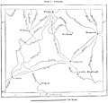
AFR V2 D535 Routes of the chief explorers between Algeria and the Tuareg territory.jpg 1,738 × 1,669; 140 KB
-
AFR V2 D536 Geology of the Sahara, south of Algeria.jpg 1,788 × 1,964; 633 KB
-
AFR V2 D552 Issawan valley.jpg 1,873 × 2,318; 402 KB
-
AFR V2 D556 Gurara and Wed Saura.jpg 1,830 × 1,659; 307 KB
-
AFR V2 D562 Thwat and Tidikelt.jpg 1,741 × 1,294; 190 KB
-
AFR V2 D567 Air, Morrocco.jpg 1,342 × 2,332; 211 KB
-
AFR V2 D572 Routes of the chief explorers in the western Sahara.jpg 1,852 × 2,024; 319 KB
-
AFR V2 D577 Rio de Oro.jpg 1,634 × 2,146; 311 KB
-
AFR V3 D040 Volcanic Axis of the Azores.jpg 2,061 × 1,823; 837 KB
-
AFR V3 D050 San-Miguel - Azores.jpg 1,960 × 1,423; 499 KB
-
AFR V3 D051 Val das Furnas - Azores.jpg 2,038 × 2,763; 1.76 MB
-
AFR V3 D052 Sete Cidades - Pona-Delgada - Azores.jpg 2,075 × 2,774; 1.33 MB
-
AFR V3 D056 Ponta Delgada - Azores.jpg 2,083 × 2,062; 736 KB
-
AFR V3 D057 Central Islands of the Azores Archipelago.jpg 2,029 × 1,781; 672 KB
-
AFR V3 D060 Island of Corvo - Azores.jpg 2,137 × 2,999; 1.48 MB
-
AFR V3 D075 Funchal and Socorridos Valley - Madeira.jpg 2,054 × 2,888; 1.39 MB
-
AFR V3 D109 Cape Verd Islands.jpg 2,048 × 2,097; 832 KB
-
AFR V3 D115 Santo-Antam and Sam Vincente - Cape Verde.jpg 2,016 × 2,334; 949 KB
-
AFR V3 D116 Part of the Volcanic Plateau in Santo-Antam - Cape Verde.jpg 2,108 × 1,944; 1.19 MB
-
AFR V3 D121 Praia - Cape Verde Islands.jpg 2,008 × 1,777; 606 KB
-
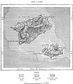
AFR V3 D126 Tristam de Cunha.jpg 2,173 × 2,675; 1.2 MB
-
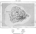
AFR V3 D139 Ascension Island.jpg 2,209 × 2,093; 818 KB
-
AFR V3 D141 Sam-Thomé.jpg 2,120 × 2,778; 1.09 MB
-
AFR V3 D147 Fernando-Po.jpg 2,141 × 2,663; 1.41 MB
-
AFR V3 D148 Bay of Santa-Isabel.jpg 2,169 × 2,278; 863 KB
-
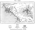
AFR V3 D158 Geological Map of Senegambia.jpg 1,764 × 3,156; 1.21 MB
-
AFR V3 D162 Senegal left half of map.jpg 2,866 × 4,594; 989 KB
-
AFR V3 D162 Senegal map left page.jpg 2,866 × 4,272; 1,010 KB
-
AFR V3 D163 Senegal map right page.jpg 2,902 × 4,365; 429 KB
-
AFR V3 D163 Senegal right side of the map.jpg 2,902 × 4,616; 422 KB
-
AFR V3 D166 The Felu Falls.jpg 2,051 × 2,123; 954 KB
-
AFR V3 D169 Bars of the Senegal from 1825 to 1884.jpg 897 × 2,978; 456 KB
-
AFR V3 D176 Natural Divisions of Senegambia.jpg 2,062 × 1,412; 294 KB
-
AFR V3 D177 Chief Nations and Tribes of Senegambia.jpg 2,063 × 1,346; 269 KB
-
AFR V3 D182 Distribution of the Fulahs in West Africa.jpg 2,022 × 1,325; 275 KB
-
AFR V3 D190 Mineral Regions of Bambuk.jpg 1,958 × 3,011; 476 KB
-
AFR V3 D192 Trade Routes and Projected Railways in Senegal.jpg 2,056 × 1,839; 314 KB
-
AFR V3 D194 The Bafoulabé Railway.jpg 2,064 × 2,649; 424 KB
-
AFR V3 D197 Gulf and Island of Arguin.jpg 2,036 × 2,152; 720 KB
-
AFR V3 D201 Rufisque.jpg 2,092 × 1,900; 529 KB
-
AFR V3 D205 Bafulabé.jpg 2,043 × 1,467; 334 KB
-
AFR V3 D206 Rock of Kita.jpg 2,224 × 2,215; 803 KB
-
AFR V3 D208 Timbo and the Sources of Bafing.jpg 1,889 × 1,883; 732 KB
-
AFR V3 D211 Political Divisions of French Senegambia.jpg 2,090 × 1,953; 532 KB
-
AFR V3 D214 Sources of the Dimma and Comba.jpg 2,097 × 2,497; 639 KB
-
AFR V3 D218 Bathurst and entrance of the Gambia.jpg 2,082 × 2,575; 770 KB
-
AFR V3 D222 Tribes of the Casamanza.jpg 2,079 × 1,701; 578 KB
-
AFR V3 D224 Tribes of the Casamanza.jpg 2,077 × 1,716; 563 KB
-
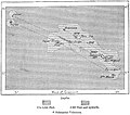
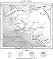
AFR V3 D231 Bissagos Archipelago.jpg 1,480 × 2,693; 692 KB
-
AFR V3 D237 Tribes of the Casamanza.jpg 567 × 599; 54 KB
-
AFR V3 D240 The Los Islands.jpg 2,051 × 2,436; 975 KB
-
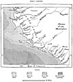
AFR V3 D243 Rivers of the South.jpg 2,027 × 1,815; 515 KB
-
AFR V3 D244 Inhabitants of the Rivers of the South.jpg 2,044 × 1,802; 541 KB
-
AFR V3 D247 Peninsula of Sierra-Leone.jpg 2,208 × 3,104; 1.05 MB
-
AFR V3 D252 Territory of the Western Mandingans in Sierra-Leone.jpg 1,986 × 2,223; 530 KB
-
AFR V3 D253 Inhabitants of Sierra-Leone.jpg 1,981 × 2,209; 471 KB
-
AFR V3 D256 Freetown - Sierra Leon.jpg 2,094 × 1,919; 762 KB
-
AFR V3 D261 Territories annexed to the Colony of Monrovia.jpg 2,029 × 2,124; 401 KB
-
AFR V3 D264 Chief Routes of Explorers in Liberia.jpg 1,617 × 2,174; 414 KB
-
AFR V3 D269 Territory of the Kroomen.jpg 2,076 × 1,854; 488 KB
-
AFR V3 D271 Inhabitants of Liberia.jpg 2,012 × 2,106; 623 KB
-
AFR V3 D272 Robertsport and Fisherman's Lake.jpg 2,101 × 2,172; 782 KB
-
AFR V3 D274 Monrovia and the Lower St Paul River.jpg 1,544 × 2,815; 682 KB
-
AFR V3 D275 Grand Bassa and Mouth of the St John.jpg 2,009 × 2,509; 813 KB
-
AFR V3 D278 Cape Palmas.jpg 2,013 × 1,478; 370 KB
-
AFR V3 D279 Ditch of Little Bassam.jpg 2,081 × 1,931; 446 KB
-
AFR V3 D281 Assini.jpg 2,025 × 2,040; 480 KB
-
AFR V3 D288 Routes of Chief Explorers North and East of Cape Coast.jpg 1,480 × 2,615; 357 KB
-
AFR V3 D290 The Lower Volta.jpg 2,040 × 2,040; 430 KB
-
AFR V3 D298 Route from Accra to Cumassi.jpg 2,037 × 2,012; 579 KB
-
AFR V3 D299 Gold Coast Possessions and Surrounding Districts.jpg 2,100 × 1,700; 333 KB
-
AFR V3 D300 Inhabitants of the Gold Coast and Surrounding Districts.jpg 2,130 × 1,731; 342 KB
-
AFR V3 D307 From Accra to the Sanatorium of Abouri.jpg 1,542 × 2,713; 459 KB
-
AFR V3 D309 Abetifi Mountains.jpg 2,041 × 2,123; 1,002 KB
-
AFR V3 D310 Mouths of the Volta.jpg 2,082 × 2,807; 788 KB
-
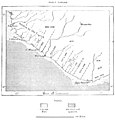
AFR V3 D314 Shore-Line East of Lagos.jpg 2,066 × 2,311; 796 KB
-
AFR V3 D317 Inhabitants of the Slave Coast.jpg 2,067 × 2,015; 402 KB
-
AFR V3 D322 Togo District.jpg 2,068 × 1,637; 516 KB
-
AFR V3 D324 Dahomey and Ajuda Coast.jpg 1,336 × 2,356; 321 KB
-
AFR V3 D328 Lagos Nigeria.jpg 2,116 × 2,672; 929 KB
-
AFR V3 D335 Hypotheses of the Old Explorers on the Course of the Niger.jpg 2,022 × 1,662; 167 KB
-
AFR V3 D336 Chief Routes of the Explorers in the Niger Valley West of Benue.jpg 2,104 × 2,212; 466 KB
-
AFR V3 D338 Upper Niger Valley.jpg 2,078 × 2,760; 1,023 KB
-
AFR V3 D340 Backwaters South of Timbuktu.jpg 1,249 × 2,643; 258 KB
-
AFR V3 D341 The Burum Defiles.jpg 2,012 × 1,459; 214 KB
-
AFR V3 D342 The Bussa Rapids.jpg 1,223 × 2,955; 445 KB
-
AFR V3 D343 Confluence of the Niger and Benoue.jpg 1,589 × 2,942; 800 KB
-
AFR V3 D345 Mouths of the Nun and Brass.jpg 592 × 600; 106 KB
-
AFR V3 D347 Ancient Empire of the Toucouleurs.jpg 2,150 × 2,134; 692 KB
-
AFR V3 D348 Inhabitants of the Upper Niger.jpg 1,994 × 2,462; 295 KB
-
AFR V3 D351 The Dio Watershed Between the Niger and Senegal.jpg 2,055 × 1,302; 354 KB
-
AFR V3 D353 Bamaku.jpg 2,057 × 1,523; 432 KB
-
AFR V3 D354 Segu Mali.jpg 2,014 × 1,660; 299 KB
-
AFR V3 D361 Timbuktu.jpg 2,018 × 1,507; 294 KB
-
AFR V3 D365 The Races of West Africa.jpg 2,173 × 1,856; 704 KB
-
AFR V3 D370 Range of Mohammedanism in Central Africa.jpg 2,168 × 1,440; 506 KB
-
AFR V3 D374 Katsena and Dankama.jpg 1,609 × 1,587; 235 KB
-
AFR V3 D375 Kano Nigeria.jpg 2,014 × 1,446; 141 KB
-
AFR V3 D376 Plan of Sokoto and Map of Haussa, Drawn by Sultan Bello.jpg 2,064 × 1,358; 258 KB
-
AFR V3 D378 Gando and Sokoto.jpg 2,185 × 2,596; 288 KB
-
AFR V3 D380 Rabba Nigeria.jpg 2,064 × 1,454; 416 KB
-
AFR V3 D382 Coast of Benin left side of Map.jpg 2,754 × 4,069; 1.41 MB
-
AFR V3 D382 The Niger map left page.jpg 2,866 × 4,339; 895 KB
-
AFR V3 D383 Niger right side of map.jpg 2,834 × 4,257; 806 KB


.png/120px-AfLIA_member_countries_(2019).png)


