Category:Maps of Ghana
Jump to navigation
Jump to search
Countries of Africa: Algeria · Angola · Benin · Botswana · Burkina Faso · Burundi · Cameroon · Cape Verde · Central African Republic · Chad · Comoros · Democratic Republic of the Congo · Republic of the Congo · Djibouti · Egypt‡ · Equatorial Guinea · Eritrea · Eswatini · Ethiopia · Gabon · The Gambia · Ghana · Guinea · Guinea-Bissau · Ivory Coast · Kenya · Lesotho · Liberia · Libya · Madagascar · Malawi · Mali · Mauritania · Mauritius · Morocco · Mozambique · Namibia · Niger · Nigeria · Rwanda · São Tomé and Príncipe · Senegal · Seychelles · Sierra Leone · Somalia · South Africa · South Sudan · Sudan · Tanzania · Togo · Tunisia · Uganda · Zambia · Zimbabwe
Limited recognition: Ambazonia · Azawad · Puntland · Sahrawi Arab Democratic Republic · Somaliland – Other areas: Canary Islands · Ceuta · Madeira · Mayotte · Melilla · Réunion · Saint Helena, Ascension and Tristan da Cunha · Scattered Islands in the Indian Ocean · Western Sahara
‡: partly located in Africa
Wikimedia category | |||||
| Upload media | |||||
| Instance of | |||||
|---|---|---|---|---|---|
| Category combines topics | |||||
 | |||||
Subcategories
This category has the following 34 subcategories, out of 34 total.
- Blank maps of Ghana (8 F)
B
- Maps of borders of Ghana (3 F)
C
D
E
F
G
H
L
- Linguistic maps of Ghana (6 F)
- Location maps of Ghana (4 F)
M
- Maps of Cape Coast (1 F)
- Maps of Koforidua (1 F)
- Maps of the Bight of Benin (15 F)
O
P
R
S
- Maps of Sekondi-Takoradi (2 F)
T
W
Pages in category "Maps of Ghana"
The following 2 pages are in this category, out of 2 total.
Media in category "Maps of Ghana"
The following 42 files are in this category, out of 42 total.
-
 Ghana–Ashanti–Kumasi location map.png 248 × 335; 39 KB
-
.pdf/page1-120px-20230530_West_%26_Central_Africa_Complex_Crisis(1).pdf.jpg) 20230530 West & Central Africa Complex Crisis(1).pdf 1,754 × 1,239; 728 KB
20230530 West & Central Africa Complex Crisis(1).pdf 1,754 × 1,239; 728 KB
-
.png/120px-20230530_West_%26_Central_Africa_Complex_Crisis(1).png) 20230530 West & Central Africa Complex Crisis(1).png 3,509 × 2,482; 10.26 MB
20230530 West & Central Africa Complex Crisis(1).png 3,509 × 2,482; 10.26 MB
-
 Admiralty Chart No 1359 Grand Jack to Cape Three Points, Published 1955.jpg 16,273 × 11,076; 20.9 MB
-
 African Cup of Nations 2008 results.png 677 × 681; 33 KB
-
 Akanland..png 1,280 × 1,061; 1,019 KB
-
 Ashantiland.png 1,280 × 1,061; 1.01 MB
-
 District map of Saboba.jpg 667 × 1,000; 43 KB
-
 ECDM 20150605 Worlds Events.pdf 1,625 × 1,125; 444 KB
-
 ECDM 20160613 World SevereWeather.pdf 1,625 × 1,125; 588 KB
-
 ECDM 20160614 World SevereWeather.pdf 1,625 × 1,125; 555 KB
-
 ECHO Ghana Editable A4 Portrait.pdf 1,239 × 1,754; 321 KB
-
 ECHO Ghana Editable A4 Portrait.png 794 × 1,123; 324 KB
-
 FLII Ghana.png 741 × 852; 403 KB
-
 Gawest.png 200 × 96; 26 KB
-
 GH N1 highway route.png 891 × 1,263; 101 KB
-
 Ghana - DPLA - 3f27128eb5569e1021c3272c502c502d.jpg 2,552 × 3,278; 5.78 MB
-
 Ghana - DPLA - 69f8ac012719a367a8e2dba795a6ec32.jpg 2,556 × 3,278; 6.88 MB
-
 Ghana Base Map.png 750 × 974; 305 KB
-
 Ghana districts blank.png 816 × 1,056; 30 KB
-
 GHANA empire map BLANK.png 1,580 × 988; 36 KB
-
 Ghana empire map.png 984 × 864; 51 KB
-
 Ghana Hydrogeology3.png 606 × 913; 23 KB
-
 GHANA MAP.jpg 1,048 × 1,120; 144 KB
-
 Ghana National Highway Network.png 891 × 1,263; 97 KB
-
 Ghana regional phone codes.jpg 2,048 × 3,072; 1.64 MB
-
 Ghana reich karte-es.svg 706 × 721; 781 KB
-
 Ghana reich karte.png 2,321 × 2,475; 438 KB
-
 Ghana's relief map.jpg 684 × 1,216; 123 KB
-
 Ghana-map.png 5,000 × 7,149; 5.05 MB
-
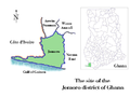 GhanaJomoroDistrict.png 720 × 540; 130 KB
-
 Keta Lagoon Map.jpg 702 × 617; 58 KB
-
 Map of Banda District.jpg 1,355 × 1,675; 175 KB
-
-
 Mapa ghana-pt.svg 512 × 442; 14 KB
-
 Reich von ghana.png 1,580 × 988; 41 KB
-
.svg/120px-The_Ghanan_coast_(Open_Maps_and_the_IMW).svg.png) The Ghanan coast (Open Maps and the IMW).svg 1,140 × 498; 1.44 MB
The Ghanan coast (Open Maps and the IMW).svg 1,140 × 498; 1.44 MB
-
 Un-ghana.png 2,367 × 3,092; 1.87 MB
-
 Volta districts.png 1,056 × 816; 43 KB
-
 Western Togoland.svg 1,153 × 1,345; 257 KB
-
 Woertehe-hong bai hei-zh-tw.png 1,000 × 1,217; 692 KB
-
 Woertehe-hong bai hei-zh.png 1,000 × 1,217; 484 KB

.png)


.svg)


