Category:Maps of Guatemala
Jump to navigation
Jump to search
Countries of North America: Antigua and Barbuda · The Bahamas · Barbados · Belize · Canada · Costa Rica · Cuba · Dominica · Dominican Republic · El Salvador · Grenada · Guatemala · Haiti · Honduras · Jamaica · Mexico · Nicaragua · Panama · Saint Kitts and Nevis · Saint Lucia · Saint Vincent and the Grenadines · Trinidad and Tobago‡ · United States of America‡
Other territories: Anguilla · Bermuda · British Virgin Islands · Cayman Islands · Florida Keys · Greenland · Guadeloupe · Martinique · Montserrat · Puerto Rico · Saint Barthélemy · Saint-Martin · Saint Pierre and Miquelon · Turks and Caicos Islands · United States Virgin Islands
‡: partly located in North America
Wikimedia category | |||||
| Upload media | |||||
| Instance of | |||||
|---|---|---|---|---|---|
| Category combines topics | |||||
 | |||||
Subcategories
This category has the following 33 subcategories, out of 33 total.
B
- Maps of borders of Guatemala (35 F)
- Blank maps of Guatemala (4 F)
C
D
E
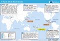
- ECHO Daily Maps of Guatemala (13 F)
F
G
H
I
- Insolation maps of Guatemala (7 F)
L
- Linguistic maps of Guatemala (9 F)
M
- Maps of Guatemala on stamps (1 F)
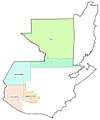
- Maps of regions of Guatemala (7 F)
O
- OpenStreetMap maps of Guatemala (16 F)
S
T
- Transport maps of Guatemala (11 F)
W
Pages in category "Maps of Guatemala"
The following 2 pages are in this category, out of 2 total.
Media in category "Maps of Guatemala"
The following 103 files are in this category, out of 103 total.
-
_kaminaljuyu.png/120px-(guatemala)_kaminaljuyu.png) (guatemala) kaminaljuyu.png 2,000 × 949; 497 KB
(guatemala) kaminaljuyu.png 2,000 × 949; 497 KB
-
_Tikal.gif/120px-(Guatemala)_Tikal.gif) (Guatemala) Tikal.gif 502 × 393; 38 KB
(Guatemala) Tikal.gif 502 × 393; 38 KB
-
 20150108 ECHO Central America Food Insecuity A3.pdf 2,100 × 1,575; 348 KB
-
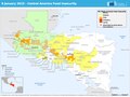
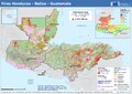 20240603 Fires Honduras Belize Guatemala.pdf 1,754 × 1,239; 487 KB
-
 20240603 Fires Honduras Belize Guatemala.png 3,508 × 2,481; 8.33 MB
-
 A glimpse of Guatemala - Map of Guatemala.jpg 2,612 × 3,382; 2.19 MB
-
 Admiralty Chart No 2988 Puerto Cortes, Published 1972.jpg 8,241 × 11,247; 13.74 MB
-
 Areas Metropolitanas de Guatemala.png 1,559 × 1,635; 602 KB
-
 BarillasGUA.svg 744 × 1,052; 75 KB
-
 Bay of Honduras.jpg 3,500 × 2,780; 2.27 MB
-
.jpg/117px-Calakmul_(Yukatan).jpg) Calakmul (Yukatan).jpg 1,755 × 1,800; 182 KB
Calakmul (Yukatan).jpg 1,755 × 1,800; 182 KB
-
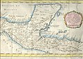
_Capitanía_General_de_Guatemala.pdf/page1-120px-Carta_náutica_de_América_Central_(1790)_Capitanía_General_de_Guatemala.pdf.jpg) Carta náutica de América Central (1790) Capitanía General de Guatemala.pdf 11,631 × 7,541; 2.82 MB
Carta náutica de América Central (1790) Capitanía General de Guatemala.pdf 11,631 × 7,541; 2.82 MB
-
 CENTROS DE OPERACIONES.png 829 × 923; 150 KB
-
 Centros de trabajo del Programa Moscamed de Guatemala.jpg 704 × 808; 38 KB
-
 Centros de trabajo.png 851 × 1,020; 171 KB
-
 Centros Moscamed.jpg 851 × 1,020; 58 KB
-
 Chinamita Territory map.png 2,356 × 1,489; 2.05 MB
-
 Corredorseco guatemala.jpg 1,160 × 1,276; 466 KB
-
.jpg/109px-Departamentos_de_Guatemala_(sin_etiquetas).jpg) Departamentos de Guatemala (sin etiquetas).jpg 545 × 599; 59 KB
Departamentos de Guatemala (sin etiquetas).jpg 545 × 599; 59 KB
-
 ECDM 20140227 CentralSouthAmerica Events.pdf 1,625 × 1,125; 504 KB
-
 ECDM 20140303 World Events.pdf 1,625 × 1,125; 645 KB
-
 ECDM 20140317 SouthAmerica Events.pdf 1,625 × 1,125; 480 KB
-
 ECDM 20140603 World Events.pdf 1,625 × 1,125; 400 KB
-
 ECDM 20140612 SAmerica Floods.pdf 1,625 × 1,125; 434 KB
-
 ECDM 20140708 MexicoGuatemala Earthquake.pdf 1,625 × 1,125; 650 KB
-
 ECDM 20140710 World Events.pdf 1,625 × 1,125; 527 KB
-
 ECDM 20140731 World Events.pdf 1,625 × 1,125; 366 KB
-
 ECDM 20141121 World Events.pdf 1,625 × 1,125; 409 KB
-
 ECDM 20141212 World Events.pdf 1,625 × 1,125; 409 KB
-
 ECDM 20150624 World Events.pdf 1,625 × 1,125; 495 KB
-
 ECDM 20150813 World Events.pdf 1,625 × 1,125; 452 KB
-
 ECDM 20150904 World events.pdf 1,625 × 1,125; 745 KB
-
 ECDM 20150929 Worldevents.pdf 1,625 × 1,125; 459 KB
-
 ECDM 20151001 World Events.pdf 1,625 × 1,125; 464 KB
-
 ECDM 20151005 World SevereWeather.pdf 1,625 × 1,125; 515 KB
-
 ECDM 20160613 World SevereWeather.pdf 1,625 × 1,125; 588 KB
-
 ECDM 20160712 World events.pdf 1,625 × 1,125; 893 KB
-
 ECDM 20160804 TC EARL.pdf 1,625 × 1,125; 760 KB
-
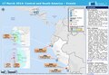
 ECDM 20160829 ECHO CentralAmericaMap.pdf 1,625 × 1,125; 591 KB
-
 ECDM 20160908 World Severe Weather.pdf 1,625 × 1,125; 1.02 MB
-
 ECDM 20160920 World events.pdf 1,625 × 1,125; 678 KB
-
 ECDM 20170912 MEXICO EQ.pdf 1,625 × 1,125; 773 KB
-
 ECDM 20171006 TC-SIXTEEN.pdf 2,479 × 1,754; 1.58 MB
-
 ECDM 20171009 TC-NATE.pdf 2,479 × 1,754; 1.64 MB
-
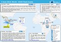
 ECDM 20190603 Central-America Food-Insecurity.pdf 1,754 × 1,239; 742 KB
-
 ECDM 20200603 Central-America TCs.pdf 1,625 × 1,125; 758 KB
-
 ECDM 20200824 TCs LAURA MARCO.pdf 1,625 × 1,125; 602 KB
-
 ECDM 20200831 TC LAURA Overview.pdf 1,625 × 1,125; 542 KB
-
 ECDM 20200903 TC NANA.pdf 1,625 × 1,125; 1.87 MB
-
 ECDM 20201007 TCs DELTA GAMMA.pdf 1,625 × 1,125; 641 KB
-
 ECDM 20201028 TC ZETA.pdf 1,625 × 1,125; 720 KB
-
 ECDM 20201105 TC ETA.pdf 1,625 × 1,125; 504 KB
-
.pdf/page1-120px-ECDM_20201116_TC-IOTA(1).pdf.jpg) ECDM 20201116 TC-IOTA(1).pdf 1,625 × 1,125; 635 KB
ECDM 20201116 TC-IOTA(1).pdf 1,625 × 1,125; 635 KB
-
 ECDM 20201126 TC-ETA-IOTA.pdf 1,625 × 1,125; 628 KB
-
 ECDM 20221219 TC Hurricane Season.pdf 2,479 × 1,754; 662 KB
-
 ECHO Guatemala Editable A4 Landscape.pdf 1,754 × 1,239; 359 KB
-
 ECHO Guatemala Editable A4 Landscape.png 1,123 × 794; 358 KB
-
 FTNprojects.jpg 950 × 524; 116 KB
-
 Guatemala - DPLA - 2702a9f14ccabe4fc3120a3e26f893d6.jpg 2,554 × 3,274; 6.37 MB
-
 Guatemala - DPLA - 5cb033f2fc8fdf7c3a7f4ef1da5a75b6.jpg 8,464 × 7,563; 5.59 MB
-
 Guatemala - DPLA - b2520d5a2591ed2923ba2ffc9860bcfa.jpg 2,558 × 3,278; 6.92 MB
-
 Guatemala - DPLA - e019405dfdd9199744c619877f57cda8.jpg 2,550 × 3,274; 6.13 MB
-
 Guatemala and its region.png 713 × 690; 92 KB
-
 Guatemala disputed w1 countrymap.svg 1,000 × 1,000; 14 KB
-
 Guatemala Hochland.png 1,015 × 931; 139 KB
-
 Guatemala Karibikküste.png 1,015 × 931; 95 KB
-
 Guatemala map smn volcanos.svg 686 × 706; 66 KB
-
 Guatemala Panhandle.svg 6 × 6; 3 KB
-
 Guatemala Regionen.png 1,015 × 931; 86 KB
-
 Guatemala y reclamos.png 2,000 × 1,370; 455 KB
-
 Guatemala y territorio reclamado.png 1,920 × 1,080; 417 KB
-
 Guatemala's municipalities.jpg 720 × 698; 49 KB
-
 Guatemalahonduras.jpg 816 × 584; 167 KB
-
 Guatemalan's municipalities V2.jpg 1,440 × 1,396; 154 KB
-
 Guatemalapalma2014.JPG 681 × 749; 54 KB
-
 Guatemalaparques.jpg 960 × 1,042; 516 KB
-
 Guatepetroleo.jpg 967 × 1,078; 142 KB
-
 Inkscape-encoding-error.png 1,157 × 886; 922 KB
-
 Izabal map RU.png 1,247 × 883; 71 KB
-
 Locatoin of Panabaj-ja.png 709 × 493; 28 KB
-
 Map of Guatemala Demis.png 960 × 1,042; 496 KB
-
 Map of los altos.png 967 × 589; 30 KB
-
 MAPA AREAS TRABAJO.png 846 × 803; 133 KB
-
 Mapa del Area Metropolitana de Guatemala AMG.png 9,000 × 9,251; 68.03 MB
-
 Mapa epj guatemala.jpg 650 × 669; 55 KB
-
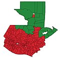
 Mapa por municipio de Guatemala según su IDH 2018.svg 512 × 536; 745 KB
-
 MAPAITZAPA.JPG 725 × 956; 67 KB
-
 Mary Recinos, daughter of the Minister of Guatemala and Senora de Recinos LCCN2016874610.jpg 7,951 × 10,012; 8.82 MB
-
 Mayamap1.gif 790 × 1,020; 23 KB
-
 Mayanlanguageslocations.png 484 × 676; 41 KB
-
 Metropolitan areas of Guatemala.png 2,043 × 2,243; 489 KB
-
 Motagua Polochic Fault.jpg 514 × 520; 64 KB
-
 Nixtun and Tayasal map, Timothy Pugh.jpg 844 × 492; 58 KB
-
 Population density of Guatemala departments.png 3,179 × 3,385; 485 KB
-
 Region of mayan.png 960 × 720; 865 KB
-
 Region03.jpg 838 × 604; 461 KB
-
 Regiones precolombinas en Guatemala.png 720 × 660; 290 KB
-
 Santiago information only for me.jpg 3,000 × 3,000; 7.02 MB
-
 Simone 1968 track NOAA Archives.JPG 125 × 112; 3 KB
-
 Un-guatemala.png 2,493 × 2,947; 1.8 MB
-
 Variaciones de tasa de pobreza entre ENCOVI 2014 Y 2023.jpg 1,918 × 2,165; 227 KB
-
 Área Metropolitana de Cobán.png 5,457 × 4,882; 9.05 MB
-
 Áreas de trabajo del Programa Moscamed de Guatemala.JPG 1,065 × 779; 62 KB
_kaminaljuyu.png)
_Tikal.gif)


.jpg)


.jpg)


