Category:Maps of Kenya
Jump to navigation
Jump to search
Countries of Africa: Algeria · Angola · Benin · Botswana · Burkina Faso · Burundi · Cameroon · Cape Verde · Central African Republic · Chad · Comoros · Democratic Republic of the Congo · Republic of the Congo · Djibouti · Egypt‡ · Equatorial Guinea · Eritrea · Eswatini · Ethiopia · Gabon · The Gambia · Ghana · Guinea · Guinea-Bissau · Ivory Coast · Kenya · Lesotho · Liberia · Libya · Madagascar · Malawi · Mali · Mauritania · Mauritius · Morocco · Mozambique · Namibia · Niger · Nigeria · Rwanda · São Tomé and Príncipe · Senegal · Seychelles · Sierra Leone · Somalia · South Africa · South Sudan · Sudan · Tanzania · Togo · Tunisia · Uganda · Zambia · Zimbabwe
Limited recognition: Ambazonia · Azawad · Puntland · Sahrawi Arab Democratic Republic · Somaliland – Other areas: Canary Islands · Ceuta · Madeira · Mayotte · Melilla · Réunion · Saint Helena, Ascension and Tristan da Cunha · Scattered Islands in the Indian Ocean · Western Sahara
‡: partly located in Africa
日本語: ケニアの地図に関するカテゴリ。
Use the appropriate category for maps showing all or a large part of Kenya. See subcategories for smaller areas:
| If the map shows | Category to use |
|---|---|
| Kenya on a recently created map | Category:Maps of Kenya or its subcategories |
| Kenya on a map created more than 70 years ago | Category:Old maps of Kenya or its subcategories |
| the history of Kenya on a recently created map | Category:Maps of the history of Kenya or its subcategories |
| the history of Kenya on a map created more than 70 years ago | Category:Old maps of the history of Kenya or its subcategories |
Wikimedia category | |||||
| Upload media | |||||
| Instance of | |||||
|---|---|---|---|---|---|
| Category combines topics | |||||
 | |||||
Subcategories
This category has the following 29 subcategories, out of 29 total.
B
C
- CIA World Factbook maps of Kenya (19 F)
D
E
- ECHO Daily Maps of Kenya (27 F)
F
I
- Insolation maps of Kenya (3 F)
K
L
- Location maps of Kenya (6 F)
M
- Maps of volcanoes in Kenya (4 F)
- Maps of Mount Kenya (25 F)
O
- OpenStreetMap maps of Kenya (16 F)
P
- Poverty maps of Kenya (4 F)
R
S
T
W
Pages in category "Maps of Kenya"
The following 2 pages are in this category, out of 2 total.
Media in category "Maps of Kenya"
The following 71 files are in this category, out of 71 total.
-
 20150120 South Sudan Neighbouring Refugees IDPs Landscape A2.pdf 3,508 × 2,479; 333 KB
-
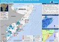
 20160120 Somalia Crisis Displacement.pdf 1,754 × 1,239; 599 KB
-
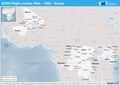 20160428 ECHO Flight.pdf 1,754 × 1,239; 445 KB
-
 20160428 ECHO Flight.png 1,123 × 794; 898 KB
-
 20170222 ECHO HornofAfrica drought Feb17.png 1,123 × 794; 613 KB
-
 20170608 SouthSudan Crisis.pdf 1,754 × 1,239; 712 KB
-
 20171124 Uganda Marburg virus ver2.pdf 1,754 × 1,239; 665 KB
-
 20180118 DailyMap SouthSudan.pdf 1,754 × 1,239; 792 KB
-
.pdf/page1-120px-20220308_Horn-of-Africa_Food-Insecurity_v3(1).pdf.jpg) 20220308 Horn-of-Africa Food-Insecurity v3(1).pdf 1,754 × 1,239; 11.8 MB
20220308 Horn-of-Africa Food-Insecurity v3(1).pdf 1,754 × 1,239; 11.8 MB
-
.png/120px-20220308_Horn-of-Africa_Food-Insecurity_v3(1).png) 20220308 Horn-of-Africa Food-Insecurity v3(1).png 1,123 × 794; 1,000 KB
20220308 Horn-of-Africa Food-Insecurity v3(1).png 1,123 × 794; 1,000 KB
-
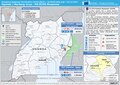
.pdf/page1-120px-20221108_Kenya_DGECHO_Response22(1).pdf.jpg) 20221108 Kenya DGECHO Response22(1).pdf 1,754 × 1,239; 585 KB
20221108 Kenya DGECHO Response22(1).pdf 1,754 × 1,239; 585 KB
-
.png/120px-20221108_Kenya_DGECHO_Response22(1).png) 20221108 Kenya DGECHO Response22(1).png 3,509 × 2,482; 4.48 MB
20221108 Kenya DGECHO Response22(1).png 3,509 × 2,482; 4.48 MB
-
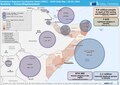
 20231108 GHoA Complex Humanitarian Crisi v5.pdf 1,754 × 1,239; 5.06 MB
-
 20231108 GHoA Complex Humanitarian Crisi v5.png 1,123 × 794; 1.05 MB
-
 Africa Map Kenya, Tanzania, Zambia, Zimbabwe.jpg 771 × 792; 81 KB
-
 African use of the shilling.png 600 × 600; 44 KB
-
 Baringosjö läge.png 977 × 1,171; 190 KB
-
 Carte Winam.png 1,276 × 873; 1.85 MB
-
 Density evolution Victoria.svg 766 × 569; 244 KB
-
 Diocese of Wote KE.svg 945 × 1,039; 304 KB
-
 ECDM 20140606 World Events.pdf 1,625 × 1,125; 501 KB
-
 ECDM 20150211 SouthSudan.pdf 1,625 × 1,125; 824 KB
-
 ECDM 20150709 SouthSudanCrisis.pdf 1,754 × 1,239; 355 KB
-
 ECDM 20150827 World Events.pdf 1,625 × 1,125; 469 KB
-
 ECDM 20151204 World SevereWeather.pdf 1,625 × 1,125; 575 KB
-
 ECDM 20151210 SouthSudan.pdf 1,625 × 1,125; 822 KB
-
 ECDM 20160105 World SevereWeather.pdf 1,625 × 1,125; 870 KB
-
 ECDM 20160119 ECHO SouthSudanCrises.pdf 1,754 × 1,239; 352 KB
-
 ECDM 20160502 World SevereWeather.pdf 1,625 × 1,125; 515 KB
-
 ECDM 20160513 World SevereWeather.pdf 1,625 × 1,125; 537 KB
-
 ECDM 20180503 Somalia Floods.pdf 2,479 × 1,754; 1.06 MB
-
 ECDM 20180601 SouthSudan Crisis.pdf 1,754 × 1,239; 827 KB
-
 ECHO Horn of Africa Region Basemap Editable A3 Landscape.png 1,344 × 1,008; 551 KB
-
 ECHO Kenya Editable A4 Landscape.pdf 1,754 × 1,239; 418 KB
-
 ECHO Kenya Editable A4 Landscape.png 1,123 × 794; 366 KB
-
 Ethiopia-Kenya Boundary.jpg 2,740 × 900; 809 KB
-
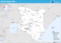
 Horn of Africa Base Map.png 1,331 × 879; 623 KB
-
 Jamiibya kenya kulingana na wanamoishi.jpg 700 × 817; 51 KB
-
 Jubbarivermap.png 1,000 × 1,000; 1.65 MB
-
 Kenya allt.svg 977 × 1,171; 754 KB
-
 Kenya Base Map.png 1,104 × 702; 397 KB
-
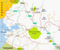
 Kenya centro sud.png 939 × 724; 296 KB
-
 Kenya Hydrogeology3.png 701 × 907; 31 KB
-
 Kenya map-astz-090907.gif 450 × 617; 47 KB
-
 Kenya meridionale.png 1,026 × 1,053; 439 KB
-
 Kenya ovest.png 567 × 473; 211 KB
-
 Kenya Regione costiera.png 877 × 1,130; 157 KB
-
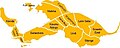
 Kenya Regions map.png 1,871 × 2,503; 1.51 MB
-
 Kenya settentrionale.png 1,398 × 895; 368 KB
-
 Kenya Updated location map.jpg 545 × 600; 153 KB
-
 Kibera - Villages division.jpg 453 × 182; 26 KB
-
 Lari Const Map.PNG 603 × 915; 79 KB
-
 Map of Africa - Kenya, Tanzania, Zambia, Zimbabwe.jpg 862 × 812; 51 KB
-
 Map-of-Kenya-showing-area-of-study.jpg 600 × 565; 91 KB
-
 Matungulu Map.jpg 640 × 474; 56 KB
-
 Mauskogen.png 597 × 568; 85 KB
-
 Migrations.gif 500 × 432; 92 KB
-
 Nairobi slums.png 331 × 551; 61 KB
-
 Nairobi slums.svg 311 × 517; 74 KB
-
 Nationalparker i kenya.png 1,108 × 1,237; 421 KB
-
 Oil Exploration Blocks in Kenya.jpg 389 × 429; 57 KB
-
 Oromo Language Map.jpg 3,024 × 4,032; 3.36 MB
-
 Shimba Hill 05.JPG 4,000 × 3,000; 3.04 MB
-
.png/116px-Stages_and_phases_Bura_Irrigation_Project_(Kenya).png) Stages and phases Bura Irrigation Project (Kenya).png 1,088 × 1,129; 188 KB
Stages and phases Bura Irrigation Project (Kenya).png 1,088 × 1,129; 188 KB
-
 SVG-Koort Kenia.svg 420 × 500; 77 KB
-
 Tight Amboseli buffer Fig6.jpg 1,024 × 725; 331 KB
-
 Tongaren-Constituency-Map.png 834 × 570; 36 KB
-
 Traditional areas inhabited by all the Somalis.png 800 × 730; 90 KB
-
 Turkanasjön läge.png 977 × 1,171; 135 KB
-
 Witu-Forest-map-Kenya.png 933 × 1,068; 62 KB
-
 Zones du the au Kenya.jpg 1,362 × 900; 193 KB


.png)
.png)


.png)


