Category:Maps of Lesotho
Jump to navigation
Jump to search
Countries of Africa: Algeria · Angola · Benin · Botswana · Burkina Faso · Burundi · Cameroon · Cape Verde · Central African Republic · Chad · Comoros · Democratic Republic of the Congo · Republic of the Congo · Djibouti · Egypt‡ · Equatorial Guinea · Eritrea · Eswatini · Ethiopia · Gabon · The Gambia · Ghana · Guinea · Guinea-Bissau · Ivory Coast · Kenya · Lesotho · Liberia · Libya · Madagascar · Malawi · Mali · Mauritania · Mauritius · Morocco · Mozambique · Namibia · Niger · Nigeria · Rwanda · São Tomé and Príncipe · Senegal · Seychelles · Sierra Leone · Somalia · South Africa · South Sudan · Sudan · Tanzania · Togo · Tunisia · Uganda · Zambia · Zimbabwe
Limited recognition: Ambazonia · Azawad · Puntland · Sahrawi Arab Democratic Republic · Somaliland – Other areas: Canary Islands · Ceuta · Madeira · Mayotte · Melilla · Réunion · Saint Helena, Ascension and Tristan da Cunha · Scattered Islands in the Indian Ocean · Western Sahara
‡: partly located in Africa
Wikimedia category | |||||
| Upload media | |||||
| Instance of | |||||
|---|---|---|---|---|---|
| Category combines topics | |||||
 | |||||
Subcategories
This category has the following 21 subcategories, out of 21 total.
B
- Maps of borders of Lesotho (1 F)
- Blank maps of Lesotho (6 F)
C
E
- ECHO Daily Maps of Lesotho (6 F)
F
H
- Maps of the history of Lesotho (18 F)
L
- Location maps of Lesotho (7 F)
M
- Maps of rivers of Lesotho (6 F)
O
P
S
T
V
- Vegetation maps of Lesotho (3 F)
Pages in category "Maps of Lesotho"
The following 2 pages are in this category, out of 2 total.
Media in category "Maps of Lesotho"
The following 9 files are in this category, out of 9 total.
-
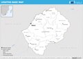 ECHO Lesotho Editable A4 Landscape.pdf 1,754 × 1,239; 254 KB
-
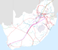 Electrical Power Grid - South Africa.png 4,092 × 3,528; 1.63 MB
-
 Lesotho - DPLA - 129f0682c73d20f207f408e471869f6c.jpg 2,558 × 3,256; 6.72 MB
-
 Lesotho - DPLA - bfe46c48fab87dda5b67db874014a908.jpg 2,550 × 3,274; 6.01 MB
-
 Lesotho - DPLA - ce038c5f90efaf26e35c9ccd262985b7.jpg 2,544 × 3,266; 5.74 MB
-
 Lesotho Hydrogeology3.png 717 × 955; 24 KB
-
 LesothosaurusFossilDiscoveriesMap.jpg 942 × 1,200; 367 KB
-
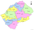 Map of lesotho-2014-25-04.png 2,464 × 2,159; 328 KB
-
 Map of lesotho.png 2,464 × 2,159; 387 KB


