Category:Maps of Lithuania
Jump to navigation
Jump to search
Wikimedia category | |||||
| Upload media | |||||
| Instance of | |||||
|---|---|---|---|---|---|
| Category combines topics | |||||
 | |||||
Subcategories
This category has the following 36 subcategories, out of 36 total.
*
- Blank maps of Lithuania (14 F)
+
A
B
C
D
E
F
G
- Geological maps of Lithuania (1 F)
H
L
M
- Maps of the Curonian Spit (22 F)
O
P
- Physical maps of Lithuania (25 F)
S
T
W
Pages in category "Maps of Lithuania"
The following 2 pages are in this category, out of 2 total.
Media in category "Maps of Lithuania"
The following 46 files are in this category, out of 46 total.
-

-
 20210920 lithuania migrants DM FINAL.pdf 1,625 × 1,125; 1.26 MB
-
 Automatinis generacijos valdymas.jpg 947 × 720; 152 KB
-
 Baltu-ciltis-12-gs.svg 1,003 × 1,096; 429 KB
-
 Buchtos..jpg 2,478 × 1,729; 2.85 MB
-
.tif/lossy-page1-97px-C-45-24-V-g(1973).tif.jpg) C-45-24-V-g(1973).tif 4,400 × 5,424; 10.12 MB
C-45-24-V-g(1973).tif 4,400 × 5,424; 10.12 MB
-
 C. 1360 Europe and Western Asia.jpg 2,112 × 1,365; 2.11 MB
-
 C. 1360 Europe.jpg 4,045 × 3,000; 3.9 MB
-
 C. 1519 Europe.jpg 4,212 × 3,212; 4.87 MB
-
 FLII Lithuania.png 1,171 × 872; 655 KB
-
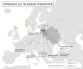
 Foreign Influence to the Lithuanian Cuisine.svg 1,200 × 1,000; 296 KB
-
 H.Kebeikis. Tiltai per Nemuną ir mažuosius jo intakus.djvu 2,416 × 3,516, 247 pages; 29.97 MB
-
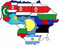
 Influences of Lithuanian cuisine during 13th - 19th centuries.svg 1,200 × 1,000; 713 KB
-
 Karačiūnai žemėlapyje.jpg 1,023 × 611; 376 KB
-
 Komp Pilgerweg.jpg 2,497 × 4,065; 394 KB
-
 Krakow sek 8 kol 3 copy.jpg 1,890 × 1,365; 763 KB
-
 Lietuvos sienų kaita su apskritimis.svg 1,117 × 903; 183 KB
-
 LietuvosSavivaldybes.png 1,246 × 1,006; 93 KB
-
 Lithuania - DPLA - 0c6006ba0d0cf505e035b32d53a647c6.jpg 2,554 × 3,274; 6.19 MB
-
 Lithuania - DPLA - 24ed2858d18266caddb1d05ea1a95360.jpg 2,552 × 3,276; 6 MB
-
 Lithuania - DPLA - 6f9e488531c9cb3efb65edabc3e22b44.jpg 2,556 × 3,278; 4.71 MB
-
 Lithuania - DPLA - e13eaab624c4ca3e1bd28e968605aec7.jpg 2,552 × 3,284; 4.84 MB
-
.jpg/120px-Lithuania_-_Migrant_Influx_EU_Civil_Protection_Mechanism_response_(cropped).jpg) Lithuania - Migrant Influx EU Civil Protection Mechanism response (cropped).jpg 3,250 × 2,098; 596 KB
Lithuania - Migrant Influx EU Civil Protection Mechanism response (cropped).jpg 3,250 × 2,098; 596 KB
-
 Lithuania - Migrant Influx EU Civil Protection Mechanism response.pdf 1,625 × 1,125; 989 KB
-
 Lithuania Administrative Divisions - DPLA - a56f36b71eefe756bb9deb1d42937f58.jpg 2,552 × 3,276; 4.67 MB
-
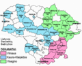
.png/120px-Lithuania_regions_map_(cs).png) Lithuania regions map (cs).png 1,533 × 1,176; 700 KB
Lithuania regions map (cs).png 1,533 × 1,176; 700 KB
-
 Lithuania-disi-map.png 1,500 × 1,107; 388 KB
-
 Lithuanian Power Plants.png 2,200 × 1,533; 5.24 MB
-
 Lmkk.png 2,200 × 1,555; 298 KB
-
 LSB ZEMELAPIS.png 623 × 503; 101 KB
-
 LT Coast location map.svg 353 × 576; 66 KB
-
 Map of influences of Lithuanian cuisine during 13th - 19th centuries, in french.svg 1,200 × 1,000; 713 KB
-
.svg/120px-Mapa_da_Lituânia_(OCHA).svg.png) Mapa da Lituânia (OCHA).svg 254 × 254; 985 KB
Mapa da Lituânia (OCHA).svg 254 × 254; 985 KB
-
 Mapa de Lituania.jpg 947 × 1,024; 71 KB
-
.jpg/120px-Mapa_etnologiczna_ludów_Litwy_i_Rusi_przerobiona_z_Atlasu_Erkerta_(J._Talko-Hryncewicz%2C_1893).jpg)
-
 MapPoster preview 20210916.png 5,087 × 3,631; 5.91 MB
-
-
 PAT - Lithuania.gif 830 × 1,000; 166 KB
-
 Planas, 1908m.jpg 2,352 × 1,674; 1.35 MB
-
 Prusy plemienne na mapie adm. Polski, Rosji i Litwy.svg 1,500 × 1,500; 2.73 MB
-
 Seniūnijų tankumas.png 1,642 × 1,268; 545 KB
-
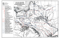 Szlaki drogowe sujkowski.png 1,175 × 764; 1,021 KB
-
 The map of the Lithuanian - Latvian land, 1900.png 9,054 × 8,547; 55.39 MB
-
 ViolentCrimePoster.png 9,933 × 7,016; 5.4 MB
-
 ВКЛ, Беларусь, Літва.jpg 1,568 × 1,734; 746 KB
-
 ХужирМузей4.jpg 3,872 × 2,592; 4.24 MB


.jpg)

.png)


.svg)

.jpg)


