Category:Maps of Luxembourg
Jump to navigation
Jump to search
Wikimedia category | |||||
| Upload media | |||||
| Instance of | |||||
|---|---|---|---|---|---|
| Category combines topics | |||||
 | |||||
Subcategories
This category has the following 35 subcategories, out of 35 total.
*
+
A
- Maps of Luxembourg in art (empty)
C
D
E
F
H
L
- Maps of Luxembourg (orange) (45 F)
M
- Maps of Pétange (4 F)
O
- OpenStreetMap maps of Luxembourg (47 F)
S
T
W
Pages in category "Maps of Luxembourg"
The following 2 pages are in this category, out of 2 total.
Media in category "Maps of Luxembourg"
The following 95 files are in this category, out of 95 total.
-
 1967 data of Benelux.jpg 4,294 × 2,864; 2.89 MB
-
 20220308 Modules deployed 2021.pdf 1,625 × 1,125; 961 KB
-
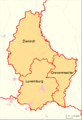
 Luxembourg administrative subdivisions coloured.gif 600 × 809; 30 KB
-
 Ardennen03.png 1,095 × 917; 150 KB
-
.jpg/120px-Belgium_and_Luxembourg_-_DPLA_-_d582af89c9c6cef3a7da38c6f2e91dff_(page_1).jpg) Belgium and Luxembourg - DPLA - d582af89c9c6cef3a7da38c6f2e91dff (page 1).jpg 7,608 × 6,494; 6.14 MB
Belgium and Luxembourg - DPLA - d582af89c9c6cef3a7da38c6f2e91dff (page 1).jpg 7,608 × 6,494; 6.14 MB
-
 Benelux, 1967.jpg 4,052 × 2,872; 2.75 MB
-

-
 Brabantse Ardennen.png 1,104 × 781; 89 KB
-
 Cantons de Clervaux, Vianden et Wiltz.png 800 × 1,141; 142 KB
-
 Cantons Luxembourg Population ES.png 1,200 × 1,660; 194 KB
-
 Cantons of Luxembourg Area.PNG 1,884 × 2,572; 324 KB
-
 Cantons of Luxembourg Highest.PNG 203 × 270; 4 KB
-
 Cantons of Luxembourg Lowest.PNG 203 × 270; 4 KB
-
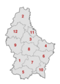 Cantons of Luxembourg numbered.png 1,480 × 2,047; 227 KB
-
 Carte Agglo.jpg 409 × 421; 47 KB
-
 Cities of Luxembourg.PNG 203 × 270; 7 KB
-
 Communes of Luxembourg Area.PNG 203 × 270; 8 KB
-
 Communes of Luxembourg Highest.PNG 203 × 270; 8 KB
-
 Communes of Luxembourg Lowest.PNG 203 × 270; 8 KB
-
 Communes of Luxembourg.png 1,356 × 1,938; 692 KB
-
 Contern Commune map Bilboard.jpg 1,200 × 1,599; 238 KB
-
 Cross border fluxes.jpg 460 × 460; 144 KB
-
 Destrikte in luxemburg.png 706 × 1,036; 35 KB
-
.png/90px-Districts_of_Luxembourg_(1857-1867).png) Districts of Luxembourg (1857-1867).png 203 × 270; 4 KB
Districts of Luxembourg (1857-1867).png 203 × 270; 4 KB
-
 Districts tribunals of Luxembourg.PNG 203 × 270; 4 KB
-
 EB Lux 5.jpg 2,094 × 2,912; 2.27 MB
-
.jpg/80px-Echternacheinsvier_(28).jpg) Echternacheinsvier (28).jpg 3,456 × 5,184; 8.96 MB
Echternacheinsvier (28).jpg 3,456 × 5,184; 8.96 MB
-
.jpg/120px-Echternacheinsvier_(30).jpg) Echternacheinsvier (30).jpg 5,184 × 3,456; 8.77 MB
Echternacheinsvier (30).jpg 5,184 × 3,456; 8.77 MB
-
 Electrical Power Grid - Luxembourg.png 2,663 × 3,528; 825 KB
-
 Empire carolingien.png 371 × 428; 44 KB
-
 FLII Luxembourg.png 704 × 863; 94 KB
-
 Gemeinden Luxemburg 2020.png 2,500 × 3,531; 1.26 MB
-
 Gemeinden Luxemburg 2023.png 2,500 × 3,531; 1.26 MB
-
 Gemeng Konstem.jpg 203 × 270; 14 KB
-
 Grafmonumenter an Tumulussen.svg 512 × 698; 202 KB
-
.svg/118px-Grand_Duchy_of_Luxembourg_(1914).svg.png) Grand Duchy of Luxembourg (1914).svg 450 × 456; 468 KB
Grand Duchy of Luxembourg (1914).svg 450 × 456; 468 KB
-
 Grenzverlauf B-LUX.png 2,093 × 2,537; 5.61 MB
-
 Grenzverlauf D-LUX.png 2,016 × 2,537; 5.4 MB
-
 Groothertogdom LuxemburgDistricten.png 203 × 270; 3 KB
-
 Groothertogdom LuxemburgGemeenten.png 203 × 270; 16 KB
-
 ISO-Codes of Luxembourg districts.png 203 × 270; 3 KB
-
 Kaart Bieles Lokalisatioun.png 500 × 333; 110 KB
-
 Kaart Minettsbaseng - nl.jpg 700 × 970; 265 KB
-
 Kaart van de Luxemburgse gemeenten.png 840 × 1,200; 533 KB
-
 Koart Käler Waasserbuerg.jpg 693 × 726; 71 KB
-
 Koart Minettsbaseng.jpg 700 × 973; 346 KB
-
 Lower tribunals of Luxembourg.png 203 × 270; 4 KB
-
 LUX250 9.tif 5,744 × 8,204; 18.78 MB
-
 Luxembourg - DPLA - 7468e23df1d24713624504855faaa55b.jpg 3,647 × 4,847; 1.57 MB
-
 Luxembourg - DPLA - 94cd49a6fdcb5ceb81c7a4fa8b2ac205.jpg 3,727 × 4,838; 1.89 MB
-
 Luxembourg - DPLA - c35f88ea109051426fc001c76d59d273.jpg 2,552 × 3,284; 7.68 MB
-
 Luxembourg - DPLA - c4b473a6933129c8679a41b92d4df81a.jpg 3,663 × 4,881; 2.1 MB
-
 Luxembourg - DPLA - f85d02a44e4a95f9c2d270956410c6ea.jpg 2,554 × 3,284; 5.78 MB
-
 Luxembourg DNI Solar-resource-map GlobalSolarAtlas World-Bank-Esmap-Solargis.png 1,842 × 2,617; 1.66 MB
-
 Luxembourg es.svg 891 × 1,162; 894 KB
-
 Luxembourg GHI Solar-resource-map GlobalSolarAtlas World-Bank-Esmap-Solargis.png 1,842 × 2,617; 1.65 MB
-
.png/92px-Luxembourg_map_(es).png) Luxembourg map (es).png 891 × 1,161; 218 KB
Luxembourg map (es).png 891 × 1,161; 218 KB
-
 Luxembourg map — Карта Люксембургу.png 974 × 1,182; 38 KB
-
 Luxembourg policezones map.svg 746 × 1,032; 1.05 MB
-
.jpg/92px-Luxembourg_Population_Density%2C_2000_(5457015531).jpg) Luxembourg Population Density, 2000 (5457015531).jpg 2,502 × 3,265; 570 KB
Luxembourg Population Density, 2000 (5457015531).jpg 2,502 × 3,265; 570 KB
-
.jpg/91px-Luxembourg_Population_Density%2C_2000_(6172442222).jpg) Luxembourg Population Density, 2000 (6172442222).jpg 2,396 × 3,161; 560 KB
Luxembourg Population Density, 2000 (6172442222).jpg 2,396 × 3,161; 560 KB
-

-
.png/81px-Luxembourg_regions_map_(cs).png) Luxembourg regions map (cs).png 2,000 × 2,960; 1.01 MB
Luxembourg regions map (cs).png 2,000 × 2,960; 1.01 MB
-

-
 Luxembourg street map.svg 2,273 × 2,650; 10.14 MB
-
 Luxembourg travel map.png 460 × 600; 120 KB
-
 Luxembourg Wikivoyage Map 2017.svg 1,506 × 2,229; 182 KB
-
 LuxembourgOMCmap.png 974 × 1,182; 27 KB
-
 Luxemburg map.png 394 × 534; 17 KB
-
 Luxgrenz.jpg 605 × 454; 43 KB
-
 Luxsüdfarb.jpg 1,185 × 797; 104 KB
-
 Luxsüdfarbtétange.jpg 1,185 × 797; 98 KB
-
 Map Nordstad.jpg 500 × 425; 58 KB
-
 Map of the Habsburg Netherlands by Alexis-Marie Gochet-es.svg 1,651 × 2,162; 1.79 MB
-
 Mapa cantonal luxemburgo area.png 203 × 267; 8 KB
-
 Mapa cantonal luxemburgo punto mas alto.png 203 × 324; 11 KB
-
 Mapa cantonal luxemburgo punto mas bajo.png 203 × 297; 9 KB
-
.svg/120px-Mapa_de_Luxemburgo_(OCHA).svg.png) Mapa de Luxemburgo (OCHA).svg 254 × 254; 941 KB
Mapa de Luxemburgo (OCHA).svg 254 × 254; 941 KB
-
.jpg/120px-Märjendaller_Klouschter_(Kaart_1785).jpg) Märjendaller Klouschter (Kaart 1785).jpg 1,487 × 1,206; 441 KB
Märjendaller Klouschter (Kaart 1785).jpg 1,487 × 1,206; 441 KB
-
.jpg/120px-Märjendaller_Klouschter_(Kaart_1825).jpg) Märjendaller Klouschter (Kaart 1825).jpg 683 × 558; 148 KB
Märjendaller Klouschter (Kaart 1825).jpg 683 × 558; 148 KB
-
 Luxembourg National Division teams 2003-04.png 203 × 270; 5 KB
-
 Luxembourg National Division teams 2004-05.png 203 × 270; 5 KB
-
 Luxembourg National Division teams 2005-06.png 203 × 270; 5 KB
-
 Luxembourg National Division teams 2006-07.png 203 × 270; 5 KB
-
 Luxembourg National Division teams 2007-08.PNG 203 × 270; 5 KB
-
 Nordstad.PNG 203 × 270; 7 KB
-
 Nordstad.svg 512 × 708; 673 KB
-
 PAT - Luxembourg.gif 830 × 1,035; 320 KB
-
 Luxembourg police forces.PNG 203 × 270; 5 KB
-
 Population density of Luxembourg districts.png 2,037 × 2,241; 191 KB
-
 Stafelter OSM.JPG 418 × 407; 45 KB
-
 Südletzebuerg.jpg 1,717 × 893; 73 KB
-
 Topographic Map of Heffingen - NARA - 100384869.jpg 6,812 × 6,088; 4.71 MB
-
 Verwaltungsgliederung Lux.png 247 × 281; 10 KB
-
 Լյուքսեմբուրգի բնակչության խտությունը, 2020.png 437 × 550; 68 KB


.jpg)


.png)


.jpg)
.jpg)


.svg)


.png)


.jpg)
.jpg)

.png)


.svg)
.jpg)
.jpg)


