Category:Maps of Oman
Jump to navigation
Jump to search
Maps of Oman.
See also:
Wikimedia category | |||||
| Upload media | |||||
| Instance of | |||||
|---|---|---|---|---|---|
| Category combines topics | |||||
 | |||||
Subcategories
This category has the following 13 subcategories, out of 13 total.
C
- CIA World Factbook maps of Oman (22 F)
E
- ECHO Daily Maps of Oman (7 F)
F
L
- Location maps of Oman (5 F)
M
O
P
S
T
W
Pages in category "Maps of Oman"
The following 2 pages are in this category, out of 2 total.
Media in category "Maps of Oman"
The following 46 files are in this category, out of 46 total.
-
 Al Hajar mountain woodlands map.png 676 × 806; 18 KB
-
 AT1306 map.png 763 × 806; 23 KB
-
 Caliph Abu Bakr's empire at its peak2-mohammad adil rais.PNG 1,196 × 580; 44 KB
-
 COVID-19 Pandemic Cases in Oman by Governorates.png 530 × 696; 44 KB
-
 ECDM 20150608 Mexico ArabianSea TCs.jpg 1,040 × 720; 167 KB
-
 ECDM 20160310 World SW.pdf 1,625 × 1,125; 885 KB
-
 ECDM 20160412 World SevereWeather.pdf 1,625 × 1,125; 598 KB
-
 ECDM 20160826 Yemen Humanitarian Crisis.pdf 1,754 × 1,239; 817 KB
-
 ECDM 20180523 Arabian-Sea TCs SAGAR-MEKUNU.pdf 2,479 × 1,754; 1.03 MB
-
 ECDM 20211005 TC GULAB.pdf 2,481 × 1,754; 796 KB
-
 ECHO Oman Editable A4 Portrait.pdf 1,239 × 1,754; 247 KB
-
 ECHO Oman Editable A4 Portrait.png 794 × 1,123; 256 KB
-
 Emirats-russian.png 901 × 1,000; 107 KB
-
 Emirats.png 1,269 × 1,000; 88 KB
-
 GolfvonAdenKartevonDanielPresberger.png 800 × 668; 145 KB
-
 Iran Air 655 Strait of hormuz 80.jpg 376 × 417; 59 KB
-
 Khuriya muriya 76.jpg 436 × 360; 31 KB
-
 Location and natural drainage network of the Wadi Al Jizzi catchment - Oman.jpg 1,141 × 519; 106 KB
-
 Map of Al Qawasim.jpg 1,080 × 1,308; 39 KB
-
 Map Praying Mantis.png 517 × 378; 152 KB
-
 Maskat & Oman map-ar.png 763 × 806; 23 KB
-
 Maskat & Oman map.png 763 × 806; 21 KB
-
 Modern South Arabian Languages.svg 500 × 600; 170 KB
-
 Muscat map old.jpg 1,393 × 1,243; 83 KB
-
 Oman - Lengas.png 662 × 916; 69 KB
-
 Oman - Religion.png 573 × 635; 75 KB
-
 Oman Base Map.png 752 × 1,002; 227 KB
-
 Oman Bullhead Shark Range.png 200 × 140; 11 KB
-
.jpg/93px-Oman_Population_Density%2C_2000_(5457017321).jpg) Oman Population Density, 2000 (5457017321).jpg 2,520 × 3,265; 664 KB
Oman Population Density, 2000 (5457017321).jpg 2,520 × 3,265; 664 KB
-
.jpg/90px-Oman_Population_Density%2C_2000_(6172445268).jpg) Oman Population Density, 2000 (6172445268).jpg 2,362 × 3,160; 586 KB
Oman Population Density, 2000 (6172445268).jpg 2,362 × 3,160; 586 KB
-
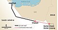 Oman Saudi Road.jpg 1,137 × 586; 155 KB
-
 Oman-Bahla.png 1,718 × 1,515; 629 KB
-
 Oman-Bat.png 2,300 × 1,590; 779 KB
-
 Oman-CIA WFB Map hu.png 991 × 1,067; 228 KB
-
 Oman. LOC 96681131.jpg 2,514 × 3,258; 719 KB
-
 Oman. LOC 96681131.tif 2,514 × 3,258; 23.43 MB
-
 Oman.PNG 2,348 × 2,947; 1.34 MB
-
 PAT - Oman.gif 800 × 1,035; 150 KB
-
 Population density of Oman governorates.png 3,856 × 4,923; 575 KB
-
 S10~03.jpg 4,713 × 6,597; 641 KB
-
 Strait of Hormuz AR.jpg 583 × 357; 106 KB
-
 Strait of Hormuz-svg-en.svg 1,264 × 1,005; 2.06 MB
-
 Strait of Hormuz.jpg 583 × 357; 54 KB
-
 خارطة سلطنة عمان.jpg 3,024 × 3,969; 2.18 MB
-
 مجان.png 397 × 411; 103 KB
-
 موطن الطهر العربي.png 328 × 353; 14 KB


.jpg)
.jpg)


