Category:Maps of South America
Jump to navigation
Jump to search
Temperate regions: North America · South America · Africa · Europe · Asia · Oceania – Polar regions: Antarctica · Arctic – Other regions: Afro-Eurasia · Eurasia
Wikimedia category | |||||
| Upload media | |||||
| Instance of | |||||
|---|---|---|---|---|---|
| Category combines topics | |||||
 | |||||
Maps of South America.
Subcategories
This category has the following 44 subcategories, out of 44 total.
!
*
+
A
- Atlas of South America (24 P, 14 F)
B
C
D
E
- ECHO Situation Maps of South America (empty)
F
G
H
I
M
O
P
S
T
W
Media in category "Maps of South America"
The following 175 files are in this category, out of 175 total.
-
0 3459 Südküste Chiles.jpg 2,499 × 1,660; 2.78 MB
-
Alkoholersterwerbsalter in Südamerika.png 2,000 × 2,678; 214 KB
-
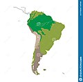
Amazon map.jpg 1,440 × 900; 198 KB
-
Amazon Reef.png 2,800 × 1,496; 136 KB
-
America distribution.jpg 1,610 × 1,600; 75 KB
-
America-del-sur-e1295595656169.jpg 318 × 448; 10 KB
-
Amicountrieslist.png 473 × 512; 56 KB
-
Anaconda Range.jpg 639 × 389; 17 KB
-
Angekommen an der karibik (12407895774).jpg 1,434 × 1,920; 2.93 MB
-
Argentina Map with Capital - South America.png 3,060 × 3,960; 557 KB
-
Ash Continues From Calbuco, 04-25-2015.jpg 1,000 × 700; 281 KB
-
Belem routes - april 2014.gif 540 × 540; 40 KB
-
Belem, Lisboa (33266135834).jpg 3,024 × 4,032; 2.65 MB
-
Blinde (blanco) Kaart van Zuid-Amerika.svg 595 × 842; 167 KB
-
Bolivia Chile Locator.png 240 × 320; 25 KB
-
Bolivia Map with Capital - South America.png 3,060 × 3,960; 552 KB
-
Bolivia Street View Coverage.png 520 × 563; 183 KB
-
Brazil Map with Capital - South America.png 3,060 × 3,960; 552 KB
-
Brazil, argentina, paraguay.jpg 468 × 633; 45 KB
-
Calbuco Volcano Erupts April 23 2015 with gravity waves.jpg 720 × 480; 163 KB
-
Calcubo Ash 04-26-2015.jpg 1,000 × 700; 653 KB
-
Cap horn.png 906 × 615; 58 KB
-
Cap horn2.png 906 × 546; 71 KB
-
Cape horn.png 519 × 428; 18 KB
-
CapeHornOverviewMap.png 906 × 615; 65 KB
-
Capture am24.png 799 × 565; 982 KB
-
Che Guevara Trip map.jpg 1,232 × 2,048; 579 KB
-
Chile Map with Capital - South America.png 3,060 × 3,960; 549 KB
-
Chile1764.PNG 193 × 235; 3 KB
-
Chile1810.PNG 193 × 235; 3 KB
-
Chincha1.jpg 259 × 314; 8 KB
-
Chinchawar.jpg 259 × 314; 8 KB
-
Colombia Map with Capital - South America.png 3,060 × 3,960; 556 KB
-
Colombia Street View Coverage.png 423 × 586; 207 KB
-
Colored map south America.png 6,120 × 7,920; 945 KB
-
Composición étnica en la zona sur de Chile.png 306 × 306; 11 KB
-
Cono sur map.jpg 392 × 493; 41 KB
-
Cono Sur.png 376 × 600; 49 KB
-
Conosurazul.png 250 × 317; 14 KB
-
CONSANAT.jpg 240 × 320; 18 KB
-
Convenio Andrés Bello países.jpg 381 × 355; 25 KB
-
Copa América Chile 2015.png 637 × 801; 14 KB
-
Crioulos luso-americanos.gif 540 × 719; 130 KB
-
A history of South America, 1854-1904 (IA cu31924021182823).pdf 900 × 1,354, 801 pages; 22.48 MB
-
Current range of big-leaf mahogany in South America.jpg 517 × 414; 50 KB
-
Cuxiu mapa.jpg 107 × 130; 10 KB
-
Dakar-Rally-2009-stages.jpg 510 × 653; 66 KB
-
Distribution du quinoa en Amérique du Sud.jpg 943 × 1,242; 85 KB
-
Drake-Passage-Area-Map.tif 1,906 × 2,420; 565 KB
-
Eastern South America.png 500 × 700; 35 KB
-
ECHO South America BaseMap A4 Portrait.png 2,481 × 3,509; 430 KB
-
Ecuador Map with Capital - South America.png 3,060 × 3,960; 555 KB
-
Ecuador Street View Coverage.png 652 × 531; 274 KB
-
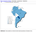
Esportacion de electricidad.png 634 × 563; 54 KB
-
ETH-BIB-Südamerika auf Europa geklappt-Dia 247-Z-00263.tif 2,955 × 3,410; 28.96 MB
-
ETH-BIB-Südamerika, Karte mit Expedition-Dia 247-Z-00063.tif 3,978 × 2,854; 32.6 MB
-
Ethnic map of South America.png 2,200 × 2,773; 452 KB
-
Falklands eilanden lokatie.png 460 × 533; 11 KB
-
French Guiana Map with Capital - South America.png 3,060 × 3,960; 556 KB
-
Frontera .jpg 927 × 777; 206 KB
-
Fronteras con el desierto.png 599 × 462; 355 KB
-
Geogr.podocnemis.expansa.jpg 1,223 × 1,280; 71 KB
-
Goethalsia plant range.png 747 × 483; 59 KB
-
Gran Premio de la America del Sur del TC.jpg 643 × 947; 66 KB
-
Green anaconda range map.png 2,687 × 2,007; 2.77 MB
-
Guyana Map with Capital - South America.png 3,060 × 3,960; 557 KB
-
Guyana Suriname Fr Guiana Location.png 7,923 × 5,176; 1.01 MB
-
Human Development in Latin America in 2013.pdf 1,272 × 1,647; 22.19 MB
-
Ist Kolumbien sicher? (13393315615).jpg 1,434 × 1,920; 2.96 MB
-
Jarawara and Jamamadí.png 807 × 990; 21 KB
-
Jose Miguel Perez-Gomez ríos convergiendo.jpg 1,285 × 997; 338 KB
-
Juan Fernández to continental Chile2.png 1,074 × 677; 493 KB
-
Juegos Parasuramericanos 2014.png 363 × 456; 18 KB
-
Khariidadda Ameerikada koonfureed.png 1,267 × 1,421; 217 KB
-
Kuschel.png 903 × 1,346; 455 KB
-
La Salle Argentina - Paraguay.jpg 800 × 1,439; 215 KB
-
LA2-South-America-UTM-zones.png 891 × 1,120; 199 KB
-
LABMAN.JPG 577 × 520; 20 KB
-
Lam Bi-chiu.png 300 × 153; 12 KB
-
Latin America homosexuality laws.jpg 640 × 755; 71 KB
-
Latin American expedition of Russian traveler Viktor Pinchuk.jpg 3,540 × 3,436; 1.71 MB
-
Linhas austral Brasil.jpg 725 × 902; 128 KB
-
Literal translation of country names.jpg 4,500 × 3,172; 1.49 MB
-
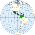
LocationWHMiddleAmerica.png 800 × 800; 50 KB
-
Lõuna-Ameerika.jpg 583 × 839; 481 KB
-
Macushi area.png 256 × 256; 34 KB
-
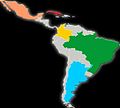
Map of Latin America.jpg 337 × 400; 25 KB
-
Map of oldest companies in South America; February 2020.png 1,200 × 1,331; 229 KB
-
Map of SACN.png 332 × 409; 10 KB
-
Map of South America by Mercosur membership.jpg 503 × 600; 82 KB
-
Map of South America-AR.png 1,131 × 1,380; 242 KB
-
Map of the Lonely island.png 964 × 966; 36 KB
-
Mapa de localização da Phalotris nasutus.png 909 × 364; 58 KB
-
Mapa de Parva Domus.png 356 × 589; 28 KB
-
Mapa esclavos.jpg 470 × 526; 43 KB
-
Mapuche map.jpg 270 × 400; 57 KB
-
Meteo Ambient.png 2,000 × 1,125; 3.84 MB
-
Middle America - DPLA - d2a31ac05bf12ee625d5ad379d111c81.jpg 3,278 × 2,554; 1.06 MB
-
Mural - mapa central - Latinoamérica.jpg 1,440 × 2,560; 1.52 MB
-
Northwest South America.png 442 × 551; 43 KB
-
P South America.png 667 × 600; 102 KB
-
Pampas Range.png 550 × 737; 362 KB
-
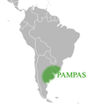
PAMPAS.png 305 × 336; 22 KB
-
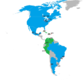
Pan American Games host countries map.png 2,000 × 1,938; 282 KB
-
Pan American Games host countries.png 2,000 × 1,938; 293 KB
-
Paraguay expedition map.png 1,545 × 2,205; 4.49 MB
-
Paraguay Map with Capital - South America.png 3,060 × 3,960; 554 KB
-
Paraguay-bolivia-1924-1935.jpg 1,023 × 311; 415 KB
-
Peru Map with Capital - South America.png 3,060 × 3,960; 552 KB
-
Peru Street View Coverage.png 473 × 556; 179 KB
-
Peruan flag map - departments.png 1,412 × 1,675; 191 KB
-
Pionites Range.png 212 × 319; 9 KB
-
President Trump at U.S. Southern Command (50108206596).jpg 3,000 × 2,000; 1.48 MB
-
Prostitution in South America.png 448 × 600; 33 KB
-
Qichwa Saywitu.svg 907 × 646; 204 KB
-
Range Psammobati normani.png 452 × 464; 278 KB
-
Regionalização da América do Sul.png 1,004 × 1,190; 156 KB
-
Reinos Aymaras.jpg 397 × 480; 61 KB
-
Repartition Bothrops bilineatus.jpg 240 × 320; 44 KB
-
RG varig 1989 brazil domestic routes.jpg 1,103 × 1,500; 415 KB
-
River uruguay map-2.PNG 399 × 600; 36 KB
-
SCCSSouthAmerica.png 226 × 330; 6 KB
-
Scotiazee en scotiarug.png 1,280 × 747; 624 KB
-
Sinusoid-south-america.jpg 1,775 × 2,048; 854 KB
-
South America - DPLA - 041a18749e649a3c4ef114e522f9c7a2.jpg 2,546 × 3,274; 7.1 MB
-
South America - DPLA - 54ce99ea65bfec690f55a624abeff39e.jpg 2,558 × 3,282; 7.04 MB
-
South America - DPLA - 73eaf49366a1b4d844fe116ecdafe2bd.jpg 2,556 × 3,272; 6 MB
-
South America - DPLA - 96413f25f33d8aaa972efb4f71fe3cfc (page 1).jpg 2,556 × 3,276; 6.21 MB
-
South America - DPLA - 96413f25f33d8aaa972efb4f71fe3cfc (page 2).jpg 2,558 × 3,278; 6.25 MB
-
South America - DPLA - c0e0dd89e6c2105a25ccaa1f7c4faa5b.jpg 2,552 × 3,268; 7.66 MB
-
South America - DPLA - f1d1b1edb5d60400bf3f7ad8bbdde708.jpg 2,550 × 3,272; 5.75 MB
-
South America - Macedonian.png 448 × 600; 42 KB
-
South America Color-coded Regions.png 1,131 × 1,376; 336 KB
-
South America First level political divisions.PNG 406 × 464; 24 KB
-
South America map maked by JPPEDRA2.jpg 2,340 × 4,160; 3.5 MB
-
South America Map with All Capital Cities.png 3,060 × 3,960; 576 KB
-
South America map with Grid.png 6,120 × 7,920; 1.34 MB
-
South America political map.png 1,300 × 2,048; 168 KB
-
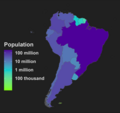
South America population map Neutral.png 1,753 × 1,649; 188 KB
-
South America satellite orthographic.jpg 1,215 × 1,712; 249 KB
-
South America satellite orthographic2.png 1,215 × 1,712; 3.39 MB
-
South America satellite plane.jpg 5,940 × 8,520; 6 MB
-
South america SCCS cultures.jpg 869 × 591; 35 KB
-
South America seismic hazard map with estimated El Tigre Fault location inset.png 1,174 × 1,127; 2.18 MB
-
South America Tsctonic Setting Map.pdf 1,275 × 1,650; 7.07 MB
-
South America.png 195 × 306; 3 KB
-
South American dryolestoid localities.webp 2,006 × 1,832; 472 KB
-
Southamerica culture map 1.jpg 459 × 684; 111 KB
-
SouthAmericaContours.svg 612 × 1,022; 41 KB
-
SouthAmerican families 03.png 995 × 1,341; 97 KB
-
Southcom aor.jpg 1,717 × 2,322; 820 KB
-
Southern Cone(Strict definition).png 541 × 541; 93 KB
-
Southern South America.png 560 × 680; 40 KB
-
Sud america ndrangheta map 2017.jpg 402 × 593; 42 KB
-
Sud por.png 380 × 600; 58 KB
-
Surconemap.png 376 × 378; 22 KB
-
Suriname Highlighted on Map of South America.png 3,905 × 4,697; 901 KB
-
Suriname Location on South America.png 8,420 × 5,950; 1.06 MB
-
Suriname Map with Capital - South America.png 3,060 × 3,960; 556 KB
-
The American Indian Fig 74.jpg 1,600 × 2,474; 360 KB
-
The Geography Class by Sydney Hayes.jpg 1,036 × 636; 260 KB
-
Tmercator-70wl.png 201 × 524; 25 KB
-
Triangulo del lito.png 1,396 × 1,930; 172 KB
-
Trigona spinipes range.jpg 240 × 320; 13 KB
-
Uruguay Map with Capital - South America.png 3,060 × 3,960; 556 KB
-
Uruguay Street View Coverage.png 529 × 528; 287 KB
-
Venezuela Map with Capital - South America.png 3,060 × 3,960; 557 KB
-
World cup south american countries best results and hosts.PNG 350 × 269; 12 KB
-
Zona de Fractura Shackleton.png 397 × 582; 238 KB
-
Geographie Universelle. T. 15 P. 1 1927 (142780322).jpg 4,819 × 6,722; 16.25 MB
-
Áreas da América do Sul.png 2,000 × 3,150; 773 KB
-
Índice de la poesía ecuatoriana contemporánea por Benjamín Carríon.png 769 × 1,262; 663 KB
-
ÑanduesSudAmerica.png 741 × 810; 194 KB
-
Гвіяна.svg 327 × 289; 10 KB




.jpg/89px-Angekommen_an_der_karibik_(12407895774).jpg)


.jpg/90px-Belem%2C_Lisboa_(33266135834).jpg)
_Kaart_van_Zuid-Amerika.svg/85px-Blinde_(blanco)_Kaart_van_Zuid-Amerika.svg.png)


.pdf/page1-80px-A_history_of_South_America%2C_1854-1904_(IA_cu31924021182823).pdf.jpg)




.jpg/89px-Ist_Kolumbien_sicher%3F_(13393315615).jpg)


%2C_NG-1064-10_(cropped).jpg/120px-Kaart_van_de_Nederlandse_Antillen_Generale_verzamelkaart_der_Nederlandsche_Westindische_Bezittingen_(titel_op_object)%2C_NG-1064-10_(cropped).jpg)











.jpg/120px-President_Trump_at_U.S._Southern_Command_(50108206596).jpg)


.jpg/94px-South_America_-_DPLA_-_96413f25f33d8aaa972efb4f71fe3cfc_(page_1).jpg)
.jpg/94px-South_America_-_DPLA_-_96413f25f33d8aaa972efb4f71fe3cfc_(page_2).jpg)




.png/120px-Southern_Cone(Strict_definition).png)




.jpg/86px-Geographie_Universelle._T._15_P._1_1927_(142780322).jpg)


