Category:Maps of Switzerland
Jump to navigation
Jump to search
Wikimedia category | |||||
| Upload media | |||||
| Instance of | |||||
|---|---|---|---|---|---|
| Category combines topics | |||||
 | |||||
Subcategories
This category has the following 64 subcategories, out of 64 total.
- Index maps of Switzerland (13 F)
#
+
A
- Animated maps of Switzerland (2 F)
- Attribution Switzerland (Mapdata documents) (2 P, 714 F)
B
- Maps of borders of Switzerland (11 F)
C
- Maps of caves in Switzerland (10 F)
D
E
F
G
H
- HDI maps of Switzerland (2 F)
L
M
O
P
- Postcode maps of Switzerland (3 F)
R
S
T
W
Pages in category "Maps of Switzerland"
The following 2 pages are in this category, out of 2 total.
Media in category "Maps of Switzerland"
The following 150 files are in this category, out of 150 total.
-
 Karte Schweiz Details.png 1,359 × 922; 327 KB
-
An-Ecological-and-Conservation-Perspective-on-Advances-in-the-Applied-Virology-of-Zoonoses-viruses-03-00379-s001.ogv 1 min 54 s, 933 × 700; 4.68 MB
-
 Ansicht Anzahl Netzwerk Versicherte in der Schweiz.jpg 1,323 × 921; 376 KB
-
 ArcGIS10.2.png 847 × 529; 460 KB
-
 BASEL STADT.png 260 × 167; 28 KB
-
 Cantons of Switserland.jpg 600 × 379; 191 KB
-
 Carte ChronoRomandie.jpg 2,528 × 1,856; 457 KB
-
 Carte des succursales.png 823 × 582; 214 KB
-
 Ch map.png 464 × 309; 33 KB
-
 CHstubmap.png 180 × 92; 3 KB
-
 Comuni svizzeri.png 998 × 669; 118 KB
-
.svg/118px-Confederation_of_Switzerland_(1914).svg.png) Confederation of Switzerland (1914).svg 450 × 456; 468 KB
Confederation of Switzerland (1914).svg 450 × 456; 468 KB
-
 CYD Campus Map Switzerland.jpg 3,144 × 1,965; 1.19 MB
-
 Decriminalization of same-sex intercourse in Switzerland.svg 1,052 × 744; 334 KB
-
 Distrib citta svizzera.png 1,359 × 922; 577 KB
-
 Distribution villes de Suisse fr.png 3,412 × 2,246; 2.47 MB
-
 Distribution villes de Suisse fr.svg 1,024 × 674; 544 KB
-
 Distribution villes de Suisse.svg 1,024 × 674; 521 KB
-
 Distribuzione città Svizzera 2011 it.png 3,413 × 2,246; 1.32 MB
-
 Dummy CH.png 450 × 307; 10 KB
-
 English-language version of Linguistic map of Switzerland.svg 512 × 512; 628 bytes
-
 Entwicklung Knotensystem Schweiz 2004-2030.gif 1,359 × 922; 1.12 MB
-
 ETH-BIB-Deklinationskarte der Schweiz 1948-Dia 247-F-00959.tif 3,600 × 2,968; 10.32 MB
-
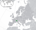 Europe-Switzerland.svg 2,045 × 1,720; 7.31 MB
-
 Firms smi exp index ch.png 543 × 451; 67 KB
-
 FLII Switzerland.png 1,434 × 872; 1.23 MB
-
 Gemeinden Schweiz 2024.png 4,000 × 2,746; 3.24 MB
-
 General Map of Switzerland.jpg 17,280 × 12,412; 66.78 MB
-
 GZA Map.jpg 962 × 753; 40 KB
-
 Infografik Total alles über die Schweiz.pdf 2,243 × 1,445; 433 KB
-
 Karte Bezirke der Schweiz 2022.png 4,133 × 2,848; 2.4 MB
-
 Karte Bezirke der Schweiz farbig 2022.png 4,133 × 2,848; 2.8 MB
-
 Karte Bezirke und Kreise der Schweiz 2022.png 4,133 × 2,848; 2.44 MB
-
 Karte Bezirke und Kreise der Schweiz farbig 2022.png 4,133 × 2,848; 2.89 MB
-
 Karte Gemeinden der Schweiz Denkmallisten.png 4,133 × 2,848; 806 KB
-
 Karte Jagdrecht Schweiz 2024.png 4,133 × 2,848; 3.44 MB
-
 Karte Kantone der Schweiz farbig 2022.png 4,133 × 2,848; 2.02 MB
-
 Karte Niederlassungen.png 669 × 453; 29 KB
-
 Karte Notariat Schweiz 2024.png 4,133 × 2,848; 3.44 MB
-
 Karte Raumplanungsregionen der Schweiz 2024.png 4,133 × 2,848; 3.88 MB
-
 KARTE schweiz verwaltungsgliederung.png 1,024 × 729; 164 KB
-
 Ks carte print 120510 UPDATED.jpg 1,500 × 1,071; 583 KB
-
 Lantus Commons Hauptaktionsradius.png 1,067 × 945; 1.22 MB
-
 Market cap smi exp index ch.png 529 × 470; 83 KB
-
 National Map of Switzerland.jpg 15,400 × 9,600; 47.49 MB
-
 Ndra in svizzera 2019.jpg 820 × 588; 123 KB
-
 Ndrangheta locali e ndrina svizzera 2018.jpg 892 × 633; 156 KB
-
 Part Europe CHE.png 100 × 64; 25 KB
-
 Partition of Switzerland.svg 600 × 660; 183 KB
-
 PAT - Switzerland.gif 920 × 920; 486 KB
-
 Population density of Switzerland cantons.png 5,630 × 4,009; 858 KB
-
 Protonmail decentralized hosting.png 936 × 634; 61 KB
-
 Raiffeisen Super League 2016 17.png 1,058 × 657; 70 KB
-
 Rasselisten Schweiz.png 1,000 × 700; 229 KB
-
 Regionalgruppen des Kaderverbandes des öffentlichen Verkehrs.jpg 902 × 561; 30 KB
-
 RegionalWikisInGermanyAustriaSwitzerland2016.jpg 700 × 700; 126 KB
-
 Regioneneinteilung Schweizer Cup 2014-15.png 4,133 × 2,690; 1 MB
-
 Rentacantonal.PNG 800 × 589; 140 KB
-
 Rhodanic Republic Map.gif 400 × 254; 12 KB
-
 River basins in Switzerland.jpg 2,048 × 1,536; 1.13 MB
-
 RTS BureauxRégionaux.png 1,280 × 720; 307 KB
-
 Répartition géographique des exploitations du REF.png 945 × 613; 686 KB
-
 SBB Stromnetz 1925.png 1,664 × 1,122; 161 KB
-
 SBB Stromnetz 1927.png 1,664 × 1,122; 189 KB
-
 SBB Stromnetz 1933.png 1,664 × 1,122; 200 KB
-
 SBB Stromnetz 1974.png 1,664 × 1,122; 230 KB
-
 SBB Stromnetz 2007.png 1,664 × 1,122; 275 KB
-
 SBB Stromnetz 2018.png 1,664 × 1,122; 285 KB
-
 SBB Stromnetz 2025.png 1,664 × 1,122; 292 KB
-
 SBB-Stromnetz 2007.png 1,595 × 1,122; 724 KB
-
 Schweiz - Kantone - Gemeinden auf 3 Ebenen.png 365 × 506; 161 KB
-
 Schweiz Aufteilung nach Gaddafi Karte.png 650 × 701; 147 KB
-
 Schweizer Rauchverbote in der Gastronomie.png 2,000 × 1,414; 239 KB
-
 Schweizer-EM-Platzierungen.PNG 1,200 × 1,000; 56 KB
-
 Seismic Hazard Map of Switzerland.png 3,507 × 2,480; 2.6 MB
-
 Sites d'Agroscope.png 1,200 × 779; 275 KB
-
.jpg/120px-Southwest_Switzerland_-_September_12th%2C_2019_(49446688566).jpg) Southwest Switzerland - September 12th, 2019 (49446688566).jpg 3,460 × 1,354; 4.79 MB
Southwest Switzerland - September 12th, 2019 (49446688566).jpg 3,460 × 1,354; 4.79 MB
-
 Standorte UFA.jpg 1,101 × 646; 144 KB
-
 Stepmap-karte-regionalgruppen-wybernet-1203604.png 640 × 480; 47 KB
-
 Städtischen Bevölkerung Schweiz 2019 de.png 3,414 × 2,247; 2.46 MB
-
.png/120px-Suisse_-_Les_sysytèmes_régionaux_d%27innovation_(RIS).png) Suisse - Les sysytèmes régionaux d'innovation (RIS).png 800 × 546; 339 KB
Suisse - Les sysytèmes régionaux d'innovation (RIS).png 800 × 546; 339 KB
-
 Suisse Cantons Carte Adoption Droit Intégrité Numérique- Fev 2023.svg 1,052 × 744; 295 KB
-
 Suisse Cantons Carte Adoption Droit Intégrité Numérique- Juin 2023.svg 1,052 × 744; 302 KB
-
 Suisse Winterthur.JPG 887 × 649; 90 KB
-
 Svizzera CIA map.gif 631 × 321; 17 KB
-
 Swiss 2005 same-sex partnerships vote.svg 1,092 × 727; 120 KB
-
 Swiss Border Guard regions map.png 526 × 372; 50 KB
-
 Swiss cantons brown.png 1,366 × 866; 44 KB
-
 Swiss Nuclear powerplant 2010.svg 1,359 × 922; 628 KB
-
 SwissArchivesMap-de.jpg 2,798 × 1,330; 707 KB
-
 Swissmap.png 972 × 640; 456 KB
-
 Swisstopo Atlas topographique Lavey-Morcles LT TA 484 1908.tif 9,200 × 7,000; 184.27 MB
-
 Swisstopo Atlas topographique Lavey-Morcles LT TA 484 1928.tif 9,200 × 7,000; 184.25 MB
-
 Swisstopo Atlas topographique Oron LT TA 454 1910.tif 9,200 × 7,000; 184.25 MB
-
 Swisstopo Atlas topographique Saxon LT TA 485 1932.tif 9,200 × 7,000; 184.25 MB
-
 Swisstopo Festungskarte Baezberg LT FK GOT 10 1926.tif 4,956 × 6,200; 87.94 MB
-
 Swisstopo Festungskarte Baezberg LT FK GOT 10 1938.tif 4,990 × 6,197; 88.5 MB
-
 Swisstopo Festungskarte Calmot LT FK GOT 12 1893a.tif 5,368 × 7,141; 109.7 MB
-
 Swisstopo Kartenprobe Le Cervin LT LK P CERVIN.tif 3,992 × 3,800; 43.42 MB
-
 Swisstopo Landeskarte Buelach LT LK 1071 1956.tif 11,400 × 8,250; 269.11 MB
-
 Swisstopo Landeskarte Dent de Morcles LT LK 1305 1962.tif 11,400 × 8,250; 269.11 MB
-
 Swisstopo Landeskarte Lachen LT LK 236 1971.tif 11,550 × 8,250; 272.64 MB
-
 Swisstopo Landeskarte Lachen LT LK 236 1989.tif 11,400 × 8,250; 269.1 MB
-
 Swisstopo Landeskarte Nufenenpass Goms - Val Bedretto - Robiei LT LK 265 T 1985.tif 11,658 × 8,525; 284.37 MB
-
 Swisstopo Landeskarte Urseren LT LK 1231 1975.tif 11,400 × 8,250; 269.1 MB
-
 Swisstopo Landeskarte Urseren LT LK 1231 1986.tif 11,400 × 8,250; 269.1 MB
-
 Swisstopo Landeskarte Val de Travers LT LK 241 1960.tif 11,550 × 8,250; 272.65 MB
-
 Swisstopo Landeskarte Vallon de St Imier LT LK 232 1953.tif 11,550 × 8,250; 272.65 MB
-
 Swisstopo Landeskarte Wildstrubel LT LK 263 1938.tif 11,550 × 8,250; 272.65 MB
-
 Swisstopo Revisionsatlas Nufenenpass LT LKR N Rev 265.jpg 11,638 × 8,512; 7.92 MB
-
_Chanrion_W_Fels_LT_LKG_GLAS_1346.tif/lossy-page1-97px-Swisstopo_Schichtgravur_auf_Glas_(Glasgravur)_Chanrion_W_Fels_LT_LKG_GLAS_1346.tif.jpg) Swisstopo Schichtgravur auf Glas (Glasgravur) Chanrion W Fels LT LKG GLAS 1346.tif 7,957 × 9,862, 2 pages; 224.58 MB
Swisstopo Schichtgravur auf Glas (Glasgravur) Chanrion W Fels LT LKG GLAS 1346.tif 7,957 × 9,862, 2 pages; 224.58 MB
-
_Col_du_Pillon_E_Fels_LT_LKG_GLAS_41.tif/lossy-page1-98px-Swisstopo_Schichtgravur_auf_Glas_(Glasgravur)_Col_du_Pillon_E_Fels_LT_LKG_GLAS_41.tif.jpg) Swisstopo Schichtgravur auf Glas (Glasgravur) Col du Pillon E Fels LT LKG GLAS 41.tif 8,027 × 9,806, 2 pages; 225.27 MB
Swisstopo Schichtgravur auf Glas (Glasgravur) Col du Pillon E Fels LT LKG GLAS 41.tif 8,027 × 9,806, 2 pages; 225.27 MB
-
_Col_du_Pillon_SW_Situation_LT_LKG_GLAS_41.tif/lossy-page1-120px-Swisstopo_Schichtgravur_auf_Glas_(Glasgravur)_Col_du_Pillon_SW_Situation_LT_LKG_GLAS_41.tif.jpg) Swisstopo Schichtgravur auf Glas (Glasgravur) Col du Pillon SW Situation LT LKG GLAS 41.tif 9,870 × 8,053, 2 pages; 227.47 MB
Swisstopo Schichtgravur auf Glas (Glasgravur) Col du Pillon SW Situation LT LKG GLAS 41.tif 9,870 × 8,053, 2 pages; 227.47 MB
-
_Dent_de_Morcles_W_Fels_LT_LGK_GLAS_1305.tif/lossy-page1-98px-Swisstopo_Schichtgravur_auf_Glas_(Glasgravur)_Dent_de_Morcles_W_Fels_LT_LGK_GLAS_1305.tif.jpg) Swisstopo Schichtgravur auf Glas (Glasgravur) Dent de Morcles W Fels LT LGK GLAS 1305.tif 8,025 × 9,822, 2 pages; 225.58 MB
Swisstopo Schichtgravur auf Glas (Glasgravur) Dent de Morcles W Fels LT LGK GLAS 1305.tif 8,025 × 9,822, 2 pages; 225.58 MB
-
_Dent_de_Morcles_W_Gewässer_LT_LGK_GLAS_1305.tif/lossy-page1-99px-Swisstopo_Schichtgravur_auf_Glas_(Glasgravur)_Dent_de_Morcles_W_Gewässer_LT_LGK_GLAS_1305.tif.jpg) Swisstopo Schichtgravur auf Glas (Glasgravur) Dent de Morcles W Gewässer LT LGK GLAS 1305.tif 8,024 × 9,765, 2 pages; 224.24 MB
Swisstopo Schichtgravur auf Glas (Glasgravur) Dent de Morcles W Gewässer LT LGK GLAS 1305.tif 8,024 × 9,765, 2 pages; 224.24 MB
-
_Dent_de_Morcles_W_Waldkonturen_LT_LGK_GLAS_1305.tif/lossy-page1-99px-Swisstopo_Schichtgravur_auf_Glas_(Glasgravur)_Dent_de_Morcles_W_Waldkonturen_LT_LGK_GLAS_1305.tif.jpg) Swisstopo Schichtgravur auf Glas (Glasgravur) Dent de Morcles W Waldkonturen LT LGK GLAS 1305.tif 7,992 × 9,711, 2 pages; 222.11 MB
Swisstopo Schichtgravur auf Glas (Glasgravur) Dent de Morcles W Waldkonturen LT LGK GLAS 1305.tif 7,992 × 9,711, 2 pages; 222.11 MB
-
_Saane_Sarine_W_Gewässer_LT_LKG_GLAS_36.tif/lossy-page1-97px-Swisstopo_Schichtgravur_auf_Glas_(Glasgravur)_Saane_Sarine_W_Gewässer_LT_LKG_GLAS_36.tif.jpg) Swisstopo Schichtgravur auf Glas (Glasgravur) Saane Sarine W Gewässer LT LKG GLAS 36.tif 7,982 × 9,815, 2 pages; 224.21 MB
Swisstopo Schichtgravur auf Glas (Glasgravur) Saane Sarine W Gewässer LT LKG GLAS 36.tif 7,982 × 9,815, 2 pages; 224.21 MB
-
_Saane_Sarine_W_Höhenlinien_LT_LKG_GLAS_36.tif/lossy-page1-98px-Swisstopo_Schichtgravur_auf_Glas_(Glasgravur)_Saane_Sarine_W_Höhenlinien_LT_LKG_GLAS_36.tif.jpg) Swisstopo Schichtgravur auf Glas (Glasgravur) Saane Sarine W Höhenlinien LT LKG GLAS 36.tif 8,023 × 9,787, 2 pages; 224.72 MB
Swisstopo Schichtgravur auf Glas (Glasgravur) Saane Sarine W Höhenlinien LT LKG GLAS 36.tif 8,023 × 9,787, 2 pages; 224.72 MB
-
_Zuerich_E_(gruen)_Situation_LT_LKG_GLAS_1091.tif/lossy-page1-98px-Swisstopo_Schichtgravur_auf_Glas_(Glasgravur)_Zuerich_E_(gruen)_Situation_LT_LKG_GLAS_1091.tif.jpg) Swisstopo Schichtgravur auf Glas (Glasgravur) Zuerich E (gruen) Situation LT LKG GLAS 1091.tif 7,992 × 9,796, 2 pages; 224.05 MB
Swisstopo Schichtgravur auf Glas (Glasgravur) Zuerich E (gruen) Situation LT LKG GLAS 1091.tif 7,992 × 9,796, 2 pages; 224.05 MB
-
_Zuerich_E_(transparent-schwarz)_Situation_LT_LKG_GLAS_1091.tif/lossy-page1-98px-Swisstopo_Schichtgravur_auf_Glas_(Glasgravur)_Zuerich_E_(transparent-schwarz)_Situation_LT_LKG_GLAS_1091.tif.jpg) Swisstopo Schichtgravur auf Glas (Glasgravur) Zuerich E (transparent-schwarz) Situation LT LKG GLAS 1091.tif 7,796 × 9,581, 2 pages; 213.77 MB
Swisstopo Schichtgravur auf Glas (Glasgravur) Zuerich E (transparent-schwarz) Situation LT LKG GLAS 1091.tif 7,796 × 9,581, 2 pages; 213.77 MB
-
 Swisstopo Topographischer Atlas Kloten LT TA 43 1949.tif 9,200 × 7,000; 184.26 MB
-
 Swisstopo Topographischer Atlas Maloja LT TA 520 1877.tif 9,200 × 7,000; 184.28 MB
-
 Swisstopo Topographischer Atlas Maloja LT TA 520 1906.tif 9,200 × 7,000; 184.28 MB
-
 Swisstopo Topographischer Atlas Saxon LT TA 485 1880.tif 9,200 × 7,000; 184.27 MB
-
 Swisstopo Topographischer Atlas Six Madun LT TA 411 1922.tif 9,200 × 7,000; 184.25 MB
-
 Swisstopo Topographischer Atlas Zuerich und Umgebung LT TA ZUS ZUER 1916.tif 16,745 × 12,362; 592.26 MB
-
 Switzerland - DPLA - 62d3bc808e17e8d3bbc2e39d065f400f.jpg 2,538 × 3,262; 6.44 MB
-
 Switzerland Administrative Divisions - DPLA - 5b87fe494753c8c633c1264e15cfc117.jpg 2,556 × 3,270; 5.52 MB
-
 Switzerland and Leichtenstein - DPLA - 469ccd597d87b21abdcbb788aa180527.jpg 4,351 × 3,795; 1.9 MB
-
 Switzerland and Leichtenstein - DPLA - 4e085c15c490611f4c62a80e672be802.jpg 4,335 × 3,835; 1.77 MB
-
 Switzerland and Liechtenstein - DPLA - af004f0ecab3c34ef2df290bbd9345a2.jpg 11,978 × 8,728; 9.67 MB
-
 Switzerland Base Map.png 1,105 × 703; 412 KB
-

-
_digital_integrity_july2024.svg/120px-Switzerland_Cantons_Map_with_Names_and_Capitals_(english)_digital_integrity_july2024.svg.png)
-
 Switzerland DNI Solar-resource-map GlobalSolarAtlas World-Bank-Esmap-Solargis.png 1,842 × 1,668; 1.93 MB
-
 Switzerland Gaddafi Map-English.png 650 × 701; 143 KB
-
 Switzerland GHI Solar-resource-map GlobalSolarAtlas World-Bank-Esmap-Solargis.png 1,842 × 1,668; 1.76 MB
-

-
 Switzerland regions HE.png 1,051 × 680; 260 KB
-
 Switzerland regions HE.svg 1,051 × 679; 558 KB
-
 Switzerland – U.S. area comparison.jpg 701 × 851; 368 KB
-
 SwitzerlandArchivesMap-fr.jpg 2,805 × 1,321; 718 KB
-
 Sz-map-eu.png 846 × 431; 186 KB
-
 TITLE.jpg 1,099 × 777; 216 KB
-
Tutorial Bundesinventare auf Swisstopo-Karte.webm 3 min 40 s, 720 × 400; 26.51 MB
-
Tutorial Swisstopo-Karten nutzen.webm 6 min 50 s, 720 × 400; 53.33 MB
-
 Unterteilung der Schweiz in zwei Regionen.png 1,508 × 958; 793 KB
-
 Wingo Abdeckung de-fr-it.pdf 1,752 × 1,239; 1.53 MB
-
 Übersichtsname Mitgliederkantone.jpg 1,073 × 732; 57 KB
-
 Положај Швајцарске на политичкој мапи Европе.png 713 × 600; 139 KB


.svg)


.png)


_digital_integrity_july2024.svg)


.jpg)