Category:Maps of Venezuela
Jump to navigation
Jump to search
Wikimedia category | |||||
| Upload media | |||||
| Instance of | |||||
|---|---|---|---|---|---|
| Category combines topics | |||||
 | |||||
Use the appropriate category for maps showing all or a large part of Venezuela. See subcategories for smaller areas:
| If the map shows | Category to use |
|---|---|
| Venezuela on a recently created map | Category:Maps of Venezuela or its subcategories |
| Venezuela on a map created more than 70 years ago | Category:Old maps of Venezuela or its subcategories |
| the history of Venezuela on a recently created map | Category:Maps of the history of Venezuela or its subcategories |
| the history of Venezuela on a map created more than 70 years ago | Category:Old maps of the history of Venezuela or its subcategories |
Subcategories
This category has the following 32 subcategories, out of 32 total.
!
(
*
A
B
- Blank maps of Venezuela (12 F)
C
D
E
- ECHO Daily Maps of Venezuela (5 F)
H
- HDI maps of Venezuela (3 F)
J
M
- Maps of Venezuela by claim (13 F)
N
O
T
- Tourist maps of Venezuela (23 F)
Pages in category "Maps of Venezuela"
The following 2 pages are in this category, out of 2 total.
Media in category "Maps of Venezuela"
The following 45 files are in this category, out of 45 total.
-
10 Venezuela.png 2,000 × 1,536; 233 KB
-
129-Imagen-2653-1-17-20200613.jpg 975 × 671; 91 KB
-
Admiralty Chart No 230 Isla de Margarita and Golfo de Cariaco, Published 1952.jpg 16,349 × 11,146; 20.28 MB
-
Arte con reciclaje en el centro de Valencia.jpg 1,600 × 1,200; 1.51 MB
-
Disputed Territories Venezuela Guyana Suriname Fr Guiana.png 8,420 × 5,950; 1.2 MB
-
ECDM 20240712 BERYL UCPM.pdf 1,625 × 1,125; 528 KB
-
FLII Venezuela.png 1,047 × 873; 805 KB
-
Gobernadores de Venezuela.svg 1,738 × 1,482; 74 KB
-
Guayana Esequiba Disputed Area Venezuela-Guyana.png 8,420 × 5,950; 1.21 MB
-
Guayana Esequiba Guyana–Venezuela territorial dispute.png 8,420 × 5,950; 1.49 MB
-
Guyana Map with Disputed Areas (Esequiba and Tigri).png 3,507 × 2,480; 534 KB
-
Journal.pntd.0010613.g001.png 3,000 × 4,708; 2.65 MB
-
Lima Group.png 1,200 × 1,209; 108 KB
-
Map Guayana Esequiba Dispute (ENG).png 8,420 × 5,950; 1.13 MB
-
Map Guayana Esequiba Dispute (SPA).png 8,420 × 5,950; 1.13 MB
-
Mapa de Venezuela, Guyana, Suriname, Guayana Francesa.png 3,007 × 1,587; 290 KB
-
Mapa del Municipio Valdez.jpg 960 × 720; 80 KB
-
Mapa físico - San Diego, Carabobo.png 4,767 × 6,704; 7.51 MB
-
Mapa presidencial de Venezuela en 1993.svg 1,660 × 1,460; 471 KB
-
Mapa Real de Venezuela.jpg 695 × 445; 49 KB
-
Mapa-de-las-Antillas-(1500).jpg 4,603 × 2,870; 3.76 MB
-
Mapa-LSRQS-web.jpg 3,026 × 2,117; 708 KB
-
MEDALLAS WIKIPEDIA-VENEZUELA.png 292 × 500; 221 KB
-
Official map of the Bolivarian Republic of Venezuela after the 2023 referendum.png 5,420 × 6,148; 8.93 MB
-
ParqueNacionalCanaima.png 5,955 × 5,469; 2.54 MB
-
PAT - Venezuela.gif 920 × 920; 208 KB
-
Physical map of Venezuela.png 823 × 723; 1.11 MB
-
Plasarea Venezuelei pe Glob.jpg 259 × 194; 11 KB
-
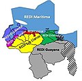
Redi s.jpg 342 × 338; 17 KB
-
Regionales Venezuela 1998.svg 1,826 × 1,548; 67 KB
-
San Gregorio Formation Map.webp 685 × 970; 153 KB
-
SEEPS.jpg 1,275 × 1,650; 173 KB
-
Tarjeta más votada de la MUD, regionales 2017.svg 1,660 × 1,460; 280 KB
-
TTBasin USGS.JPG 544 × 620; 56 KB
-
Tucupita, Venezuela.gif 447 × 351; 39 KB
-
Venezuela - DPLA - 426575850ba4e5599e95301266c542a6.jpg 3,126 × 2,410; 1.15 MB
-
Venezuela - DPLA - 83711b56429b1086e6e4ff3eee4961fd (page 1).jpg 2,554 × 3,282; 6.24 MB
-
Venezuela - DPLA - 83711b56429b1086e6e4ff3eee4961fd (page 2).jpg 2,552 × 3,284; 6.25 MB
-
Venezuela - DPLA - e92c19707de36c46c12a9433d21817f1.jpg 2,550 × 3,272; 5.83 MB
-
Venezuela actual.jpg 1,001 × 600; 74 KB
-
Venezuela Actual.svg 1,660 × 1,460; 315 KB
-
Venezuela disputed w1 countrymap.svg 1,000 × 1,000; 23 KB
-
Venezuela Guyana Essequibo dispute map.svg 301 × 205; 41 KB
-
Zona En Reclamación (Guayana Esequiba) on Guiana Shield.svg 480 × 330; 564 KB
-
Деревни мако.jpg 1,409 × 1,075; 186 KB


.png/120px-Guyana_Map_with_Disputed_Areas_(Esequiba_and_Tigri).png)


.png/120px-Map_Guayana_Esequiba_Dispute_(ENG).png)
.png/120px-Map_Guayana_Esequiba_Dispute_(SPA).png)


.jpg/120px-Mapa-de-las-Antillas-(1500).jpg)


.jpg/93px-Venezuela_-_DPLA_-_83711b56429b1086e6e4ff3eee4961fd_(page_1).jpg)
.jpg/93px-Venezuela_-_DPLA_-_83711b56429b1086e6e4ff3eee4961fd_(page_2).jpg)


_on_Guiana_Shield.svg/120px-Zona_En_Reclamación_(Guayana_Esequiba)_on_Guiana_Shield.svg.png)
