Category:OS OpenData
Jump to navigation
Jump to search
Media in category "OS OpenData"
The following 200 files are in this category, out of 21,766 total.
(previous page) (next page)-
2004 Welsh Local Elections - Ward and Council Control.svg 721 × 401; 2.38 MB
-
2008 Welsh Local Elections - Ward and Council Control.svg 721 × 401; 2.38 MB
-
2012 Welsh Local Elections - Ward and Council Control.svg 721 × 401; 2.35 MB
-
2013 UK Local Elections - Ward and Council Control.svg 623 × 569; 7.82 MB
-
2017 Scottish local elections - Ward and Council Control.svg 1,141 × 559; 8.64 MB
-
2017 UK General Election map.svg 3,257 × 6,060; 3.75 MB
-
2017 UK local elections - Ward and Council Control.svg 967 × 821; 13.23 MB
-
2017 Welsh Local Elections - Ward and Council Control.svg 721 × 401; 2.35 MB
-
2019 UK Local Elections by Ward.svg 589 × 730; 13.23 MB
-
2022 Scottish local elections - Ward and Council.svg 512 × 251; 6.81 MB
-
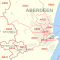
AB postcode area inset map.svg 500 × 500; 84 KB
-
AB postcode area map.svg 1,000 × 1,000; 558 KB
-
Ailsa Craig OS OpenData map.png 776 × 695; 39 KB
-
AL postcode area map.svg 1,000 × 800; 204 KB
-
Anglesey OS map.png 2,243 × 1,449; 639 KB
-
Annet island Scilly.svg 919 × 919; 177 KB
-
Arran.jpg 322 × 214; 16 KB
-
Avebury World Heritage Site map.svg 1,614 × 1,425; 904 KB
-
B postcode area inset map.svg 500 × 500; 54 KB
-
B postcode area map.svg 700 × 1,000; 996 KB
-
BA postcode area map.svg 1,000 × 1,000; 697 KB
-
Barking 2023 Constituency.svg 847 × 650; 171 KB
-
Barking and Dagenham London UK blank ward map 2022.svg 512 × 598; 1.42 MB
-
Bass Rock OS map.png 486 × 442; 16 KB
-
Battersea 2023 Constituency.svg 847 × 650; 171 KB
-
BB postcode area map.svg 1,000 × 1,000; 301 KB
-
BD postcode area map.svg 1,000 × 1,000; 716 KB
-
Beckenham and Penge 2023 Constituency.svg 847 × 650; 171 KB
-
Bedford Purlieus Map 2011.jpg 845 × 954; 149 KB
-
Bedford Purlieus Map 2011.png 845 × 954; 58 KB
-
Bedford Purlieus map showing former woodland.png 1,717 × 1,096; 635 KB
-
Belle Isle Windermere map.png 1,004 × 791; 108 KB
-
Bermondsey and Old Southwark 2023 Constituency.svg 847 × 650; 171 KB
-
Bethnal Green and Stepney 2023 Constituency.svg 847 × 650; 171 KB
-
Bexhill and Battle UK constituency map.svg 1,425 × 928; 477 KB
-
Bexley London UK blank ward map 2018.svg 512 × 619; 2.17 MB
-
Bexleyheath and Crayford 2023 Constituency.svg 847 × 650; 171 KB
-
BH postcode area map.svg 1,000 × 1,000; 315 KB
-
BL postcode area map.svg 1,000 × 800; 238 KB
-
BN postcode area inset map.svg 500 × 500; 45 KB
-
BN postcode area map.svg 1,000 × 500; 393 KB
-
Boat Race 2021 map.svg 1,312 × 2,731; 8.02 MB
-
Bootham Crescent OS OpenData map 2015.png 694 × 511; 563 KB
-
Bowdown Woods Nature Reserve map.png 1,333 × 889; 403 KB
-
BR postcode area map.svg 1,000 × 700; 235 KB
-
Bradgate park general map.png 653 × 442; 350 KB
-
Bradgate park general map.svg 512 × 724; 1.17 MB
-
Bradgate park geology map.png 529 × 397; 264 KB
-
Braemar i Monadh Rois (Montrose).jpg 532 × 295; 56 KB
-
Brent East 2023 Constituency.svg 847 × 650; 171 KB
-
Brent London UK blank ward map 2022.svg 512 × 414; 689 KB
-
Brent West 2023 Constituency.svg 847 × 650; 171 KB
-
Brentford and Isleworth 2023 Constituency.svg 847 × 650; 171 KB
-
Brentford and Lots Aits OS OpenData map.png 757 × 481; 57 KB
-
Bridgemarsh Island map.jpg 974 × 425; 151 KB
-
Bridgemarsh Island map.png 974 × 425; 71 KB
-
Brighton and Hove East Sussex UK district map.svg 1,425 × 928; 411 KB
-
Brighton Kemptown UK constituency map.svg 1,425 × 928; 477 KB
-
Brighton Pavilion UK constituency map.svg 1,425 × 928; 477 KB
-
British postcode areas map.svg 886 × 1,369; 846 KB
-
Bromley and Biggin Hill 2023 Constituency.svg 847 × 650; 171 KB
-
Bromley London UK blank ward map 2022.svg 512 × 528; 1.71 MB
-
Brownsea Island OS map.png 1,270 × 738; 101 KB
-
Brownsea Island OS OpenData map.png 1,277 × 759; 104 KB
-
Bryher island Scilly.svg 919 × 919; 188 KB
-
Bryher Isles of Scilly UK parish locator map.png 3,000 × 3,000; 79 KB
-
BS postcode area inset map.svg 500 × 500; 46 KB
-
BS postcode area map.svg 1,000 × 1,000; 543 KB
-
Buckland, Gloucestershire Map.png 1,002 × 1,003; 207 KB
-
Burrow Island OS map.png 679 × 467; 45 KB
-
CA postcode area map.svg 1,000 × 1,000; 504 KB
-
Cairngorm.jpg 420 × 254; 40 KB
-
Camden London UK labelled ward map 2022.svg 512 × 499; 79 KB
-
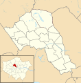
Camden UK blank ward map 2022.svg 735 × 745; 1.02 MB
-
Camden UK local election 2022 map.svg 735 × 745; 1.02 MB
-
Camden UK ward map highlighting Belsize Ward (2021).svg 735 × 745; 1,010 KB
-
Camden UK ward map highlighting Bloomsbury Ward (2021).svg 735 × 745; 1,007 KB
-
Camden UK ward map highlighting Camden Square Ward (2021).svg 735 × 745; 1,006 KB
-
Camden UK ward map highlighting Camden Town Ward (2021).svg 735 × 745; 1,007 KB
-
Camden UK ward map highlighting Fortune Green Ward (2021).svg 735 × 745; 1,010 KB
-
Camden UK ward map highlighting Frognal Ward (2021).svg 735 × 745; 1,010 KB
-
Camden UK ward map highlighting Gospel Oak Ward (2021).svg 735 × 745; 1,010 KB
-
Camden UK ward map highlighting Hampstead Town Ward (2021).svg 735 × 745; 1,012 KB
-
Camden UK ward map highlighting Haverstock Ward (2021).svg 735 × 745; 1,009 KB
-
Camden UK ward map highlighting Highgate Ward (2021).svg 735 × 745; 1,015 KB
-
Camden UK ward map highlighting Holborn & Covent Garden Ward (2021).svg 735 × 745; 1,010 KB
-
Camden UK ward map highlighting Kentish Town North Ward (2021).svg 735 × 745; 1,007 KB
-
Camden UK ward map highlighting Kentish Town South Ward (2021).svg 735 × 745; 1,006 KB
-
Camden UK ward map highlighting Kilburn Ward (2021).svg 735 × 745; 1,012 KB
-
Camden UK ward map highlighting King's Cross Ward (2021).svg 735 × 745; 1,011 KB
-
Camden UK ward map highlighting Primrose Hill Ward (2021).svg 735 × 745; 1,008 KB
-
Camden UK ward map highlighting Regent's Park Ward (2021).svg 735 × 745; 1,007 KB
-
Camden UK ward map highlighting South Hampstead Ward (2021).svg 735 × 745; 1,008 KB
-
Camden UK ward map highlighting St. Pancras & Somers Town Ward (2021).svg 735 × 745; 1,007 KB
-
Camden UK ward map highlighting West Hampstead Ward (2021).svg 735 × 745; 1,011 KB
-
Carshalton and Wallington 2023 Constituency.svg 847 × 650; 171 KB
-
Cascata dell'assino a camporeggiano.jpg 840 × 1,277; 203 KB
-
Castell coch woodlands sssi map.svg 374 × 330; 193 KB
-
CB postcode area map.svg 1,000 × 1,000; 502 KB
-
CF postcode area map.svg 1,000 × 1,000; 463 KB
-
CH postcode area map.svg 1,000 × 1,000; 488 KB
-
Charnwood wildlife and geology sites map.svg 712 × 580; 2.69 MB
-
Chelsea and Fulham 2023 Constituency.svg 847 × 650; 171 KB
-
Chingford and Woodford Green 2023 Constituency.svg 847 × 650; 171 KB
-
Chipping Barnet 2023 Constituency.svg 847 × 650; 171 KB
-
Cholesbury camp map.png 477 × 353; 18 KB
-
Cindery Island map.jpg 778 × 438; 144 KB
-
Cindery Island map.png 778 × 438; 47 KB
-
Cities of London and Westminster 2023 Constituency.svg 847 × 650; 171 KB
-
City of London Corporation election, 2013.svg 1,213 × 907; 95 KB
-
City of London Corporation election, 2017.svg 1,213 × 907; 123 KB
-
Clapham and Brixton Hill 2023 Constituency.svg 847 × 650; 171 KB
-
Cluanie Horseshoe.svg 745 × 731; 157 KB
-
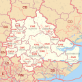
CM postcode area map.svg 1,000 × 1,000; 1.32 MB
-
CO postcode area map.svg 1,000 × 800; 471 KB
-
Cobmarsh Island map.jpg 522 × 460; 71 KB
-
Cobmarsh Island map.png 522 × 460; 23 KB
-
Combined authority mayors in the UK + parties.svg 263 × 491; 8.32 MB
-
Comhairle nan Eilean Siar election, 1999.svg 1,083 × 1,424; 3.82 MB
-
Comhairle nan Eilean Siar election, 2003.svg 1,083 × 1,424; 3.82 MB
-
Community map,Tref Alaw, Anglesey.png 367 × 395; 113 KB
-
CR postcode area map.svg 1,000 × 1,000; 346 KB
-
Croydon East 2023 Constituency.svg 847 × 650; 171 KB
-
Croydon South 2023 Constituency.svg 847 × 650; 171 KB
-
Croydon West 2023 Constituency.svg 847 × 650; 171 KB
-
CT postcode area map.svg 1,000 × 1,000; 245 KB
-
CV postcode area map.svg 700 × 1,000; 867 KB
-
CW postcode area map.svg 1,000 × 1,000; 450 KB
-
DA postcode area map.svg 1,000 × 1,000; 389 KB
-
Dagenham and Rainham 2023 Constituency.svg 847 × 650; 171 KB
-
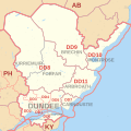
DD postcode area map.svg 1,000 × 1,000; 264 KB
-
DE postcode area map.svg 700 × 1,000; 633 KB
-
De Uist.jpg 234 × 210; 9 KB
-
Derbyshire county and vice-county comparison map.jpg 967 × 1,217; 314 KB
-
DG postcode area map.svg 1,000 × 700; 745 KB
-
DH postcode area map.svg 1,000 × 500; 263 KB
-
Directly elected mayors in the UK.svg 247 × 461; 8.06 MB
-
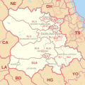
DL postcode area map.svg 1,000 × 1,000; 660 KB
-
DN postcode area map.svg 1,000 × 700; 940 KB
-
DT postcode area map.svg 1,000 × 1,000; 530 KB
-
Dulwich and West Norwood 2023 Constituency.svg 847 × 650; 171 KB
-
Durness i Loch Shin.jpg 313 × 315; 40 KB
-
DY postcode area map.svg 1,000 × 800; 430 KB
-
E postcode area map.svg 600 × 1,000; 395 KB
-
Ealing Central and Acton 2023 Constituency.svg 847 × 650; 171 KB
-
Ealing North 2023 Constituency.svg 847 × 650; 171 KB
-
Ealing Southall 2023 Constituency.svg 847 × 650; 171 KB
-
East Ham 2023 Constituency.svg 847 × 650; 171 KB
-
Eastbourne East Sussex UK district map.svg 1,425 × 928; 411 KB
-
Eastbourne UK constituency map.svg 1,425 × 928; 477 KB
-
EC postcode area map.svg 1,000 × 1,000; 114 KB
-
Edmonton and Winchmore Hill 2023 Constituency.svg 847 × 650; 171 KB
-
EH postcode area inset map.svg 500 × 500; 129 KB
-
EH postcode area map.svg 1,000 × 700; 560 KB
-
Eltham and Chislehurst 2023 Constituency.svg 847 × 650; 171 KB
-
EN postcode area map.svg 1,000 × 800; 263 KB
-
Enfield London UK blank ward map 2022.svg 512 × 405; 1.58 MB
-
Enfield North 2023 Constituency.svg 847 × 650; 171 KB
-
English unitary authorities 2020.svg 831 × 1,009; 1.3 MB
-
Erith and Thamesmead 2023 Constituency.svg 847 × 650; 171 KB
-
EX postcode area map.svg 1,000 × 700; 968 KB
-
Feltham and Heston 2023 Constituency.svg 847 × 650; 171 KB
-
Fife Council election, 1999.svg 870 × 576; 669 KB
-
Finchley and Golders Green 2023 Constituency.svg 847 × 650; 171 KB
-
Firth of Forth OS map.png 1,673 × 833; 554 KB
-
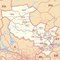
FK postcode area map.svg 1,000 × 1,000; 801 KB
-
Fort William i Loch Treig a Loch Leven.jpg 334 × 174; 27 KB
-
Foulness Island map.jpg 701 × 467; 102 KB
-
Foulness Island map.png 701 × 467; 48 KB
-
FY postcode area map.svg 500 × 1,000; 71 KB
-
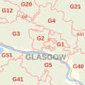
G postcode area inset map.svg 500 × 500; 46 KB
-
G postcode area map.svg 800 × 1,000; 726 KB
-
GL postcode area map.svg 1,000 × 1,000; 904 KB
-
Glasgow City Council election, 2017.svg 1,385 × 1,269; 273 KB
-
Glen Affric i Glen Moriston.jpg 281 × 138; 19 KB
-
Glen Albyn i Monadh Liath.jpg 398 × 256; 45 KB
-
Glen Etive i Glen Lochy.jpg 368 × 307; 39 KB
-
Glen Lyon i Glen Dochart a Loch Tay.jpg 543 × 254; 44 KB
-
Glen Shiel i Loch Hourn a Loch Quoich.jpg 267 × 147; 20 KB
-
Glen Tromie i Glen Tilt.jpg 232 × 248; 25 KB
-
GlenAffricPostcodeDistricts.png 776 × 514; 45 KB
-
Godrevy Cornwall map.png 1,266 × 973; 63 KB
-
Godrevy Island map.png 418 × 357; 8 KB
-
Gogledd Skye.jpg 322 × 229; 17 KB
-
Great Britain Vice Counties.png 567 × 884; 55 KB
-
Great Ganilly island Scilly.svg 919 × 919; 175 KB
-
Greenwich and Woolwich 2023 Constituency.svg 847 × 650; 171 KB
-
Greenwich London UK blank ward map 2022.svg 512 × 518; 1.82 MB
-
Greyfriars, Leicester location map.gif 501 × 500; 112 KB
-
Greyfriars, Leicester site.gif 1,655 × 1,310; 651 KB
-
Greyfriars, Leicester site.svg 1,650 × 1,579; 148 KB
-
Grimsby docks new clee stations map.png 522 × 487; 67 KB
-
GU postcode area map.svg 1,000 × 1,000; 1.04 MB
-
Gugh island Scilly.svg 919 × 919; 179 KB
-
Gweal island Scilly.svg 919 × 919; 174 KB
-
HA postcode area map.svg 1,000 × 1,000; 269 KB
-
Hackney North and Stoke Newington 2023 Constituency.svg 847 × 650; 171 KB














.jpg/120px-Braemar_i_Monadh_Rois_(Montrose).jpg)





.svg/118px-Camden_UK_ward_map_highlighting_Belsize_Ward_(2021).svg.png)
.svg/118px-Camden_UK_ward_map_highlighting_Bloomsbury_Ward_(2021).svg.png)
.svg/118px-Camden_UK_ward_map_highlighting_Camden_Square_Ward_(2021).svg.png)
.svg/118px-Camden_UK_ward_map_highlighting_Camden_Town_Ward_(2021).svg.png)
.svg/118px-Camden_UK_ward_map_highlighting_Fortune_Green_Ward_(2021).svg.png)
.svg/118px-Camden_UK_ward_map_highlighting_Frognal_Ward_(2021).svg.png)
.svg/118px-Camden_UK_ward_map_highlighting_Gospel_Oak_Ward_(2021).svg.png)
.svg/118px-Camden_UK_ward_map_highlighting_Hampstead_Town_Ward_(2021).svg.png)
.svg/118px-Camden_UK_ward_map_highlighting_Haverstock_Ward_(2021).svg.png)
.svg/118px-Camden_UK_ward_map_highlighting_Highgate_Ward_(2021).svg.png)
.svg/118px-Camden_UK_ward_map_highlighting_Holborn_%26_Covent_Garden_Ward_(2021).svg.png)
.svg/118px-Camden_UK_ward_map_highlighting_Kentish_Town_North_Ward_(2021).svg.png)
.svg/118px-Camden_UK_ward_map_highlighting_Kentish_Town_South_Ward_(2021).svg.png)
.svg/118px-Camden_UK_ward_map_highlighting_Kilburn_Ward_(2021).svg.png)
.svg/118px-Camden_UK_ward_map_highlighting_King%27s_Cross_Ward_(2021).svg.png)
.svg/118px-Camden_UK_ward_map_highlighting_Primrose_Hill_Ward_(2021).svg.png)
.svg/118px-Camden_UK_ward_map_highlighting_Regent%27s_Park_Ward_(2021).svg.png)
.svg/118px-Camden_UK_ward_map_highlighting_South_Hampstead_Ward_(2021).svg.png)
.svg/118px-Camden_UK_ward_map_highlighting_St._Pancras_%26_Somers_Town_Ward_(2021).svg.png)
.svg/118px-Camden_UK_ward_map_highlighting_West_Hampstead_Ward_(2021).svg.png)


